


Entertainment
Paul McCartney Album Review: The Boys Of Dungeon Lane Shows Icon Vulnerable
Paul McCartney's new album 'The Boys Of Dungeon Lane' offers a mix of nostalgia and rock, with tender moments and experimental tracks. A 4-star review.


Politics
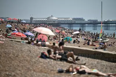
UK Records Hottest May Day as Sonny Rollins Dies at 95
The UK experiences its hottest May day with temperatures above 34C, while jazz legend Sonny Rollins passes away at 95. Other top stories include US strikes in the Strait of Hormuz and a record prison drug crisis.


Sports

David Gower Backs Emilio Gay to Shine on England Debut at Lord's
David Gower praises Emilio Gay's call-up as a return to selecting in-form county players, replacing Zak Crawley for the New Zealand Test at Lord's.


Crime

Rochdale Murder Probe After Woman Found Dead in Flat
A murder investigation has been launched after a woman in her 40s was found dead at a flat on the Freehold Estate in Rochdale. A man in his 30s has been arrested.


Health


Environment
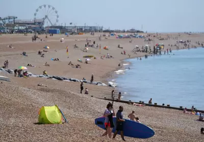
UK Hottest May Day: 34.8C Record, More Heat Expected
The UK recorded its hottest May day ever at 34.8C in Kew Gardens. Temperatures may reach 36C on Tuesday, with heatwave conditions and health alerts issued.

Massive Fish Kill in Georgia River Under Investigation
Thousands of dead fish were found along a 20-mile stretch of the Chattahoochee River in Georgia, prompting a major investigation into the cause, possibly linked to low oxygen from recent flooding.

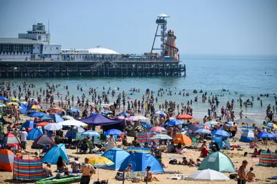
Mediterranean Cooling Secrets for UK Heatwaves
Ancient Mediterranean techniques like white roofs and shutters can cool UK homes during heatwaves, reducing indoor temperatures by up to 4°C and combating urban heat island effects.

Stay Cool Without AC: Passive Cooling Tips for UK Heatwaves
As heatwaves intensify, experts recommend passive cooling over air conditioning to reduce energy costs, emissions, and inequality. Learn how shading, ventilation, and behavior changes can keep your home cool.
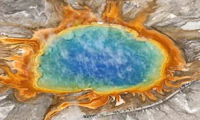
Yellowstone's Grand Prismatic Spring: Alien-Like Beauty
Explore breathtaking aerial views of Grand Prismatic Spring in Yellowstone, where vibrant blue and orange colors create a surreal landscape, thanks to heat-loving microbes.
Monday Sports Challenge: Football, Cricket & Rugby Questions
Start your week with our Monday sports quiz featuring 100 questions about British football, cricket, and rugby. How well do you know these popular UK sports?
