
Motorists across the United Kingdom are being urged to exercise extreme caution as treacherous icy conditions develop on untreated road surfaces following a dramatic temperature drop. This hazardous situation comes in the wake of widespread heavy rainfall and significant flooding brought by Storm Chandra, which has battered the country throughout January.
Met Office Issues Critical Weather Warning
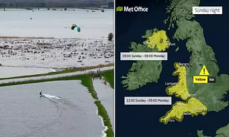
The Met Office has formally activated a yellow ice alert, which remains in effect from 10pm today through to 9am on Monday morning. The warning specifically covers the south-west of England, certain areas of Hampshire, Wales, and Northern Ireland. Within these regions, the forecaster has also highlighted the potential for dense fog patches to form, creating an additional layer of danger for early morning travellers.
A spokesperson for the Met Office provided detailed analysis of the conditions, stating: 'With wet surfaces following recent rain and temperatures falling close to or below freezing, icy patches will be possible on untreated surfaces for a time on Sunday night into Monday morning.' The official further explained the complexity of the forecast, noting: 'The extent of cloud cover across parts of Wales and central southern England is more uncertain, which will influence whether temperatures fall sufficiently low enough to allow ice to form.'

Ongoing Flood Crisis Compounds Travel Dangers
The ice warning arrives amidst a severe and ongoing flood emergency. Currently, there are 58 active flood warnings in force across England, with the majority concentrated in the counties of Somerset, Dorset, and Wiltshire. These warnings indicate that flooding is expected and that immediate action is required.
Furthermore, a broader network of 118 flood alerts has been issued nationwide, signalling that flooding is possible and that residents should remain prepared. The distinction is critical: flood warnings mean properties, businesses, critical infrastructure like railway lines and roads, major tourist sites, coastal zones, and flood plains—including caravan parks and campsites—are all at imminent risk.
In Wales, two flood alerts are active in Pembrokeshire and Powys. Scotland is contending with three flood warnings currently in force for Tayside and Orkney.
Somerset Declares Major Incident Amidst Renewed Threat
The situation remains particularly grave in Somerset, where a major incident was declared earlier this week after approximately 50 properties were inundated by floodwaters during the peak of Storm Chandra. This major incident status is still active as authorities deploy ultra-high-volume pumps in a concerted effort to drain the Somerset Levels.
Local councils have issued stark warnings that with further rainfall anticipated in Somerset, additional homes in the Moorland, Saltmoor, and Currymoor areas could be flooded. While the Environment Agency reports that water levels in the River Tone have stabilised, and the Parrett flood relief channel has been opened to assist drainage, the threat persists. Backup pumps have been installed at strategic locations including Aller Drove and Westonzoyland as a precautionary measure.
Record Rainfall and Widespread Disruption from Storm Chandra
Storm Chandra delivered historically high levels of precipitation to the south-west of Britain, triggering what officials described as 'life-threatening' flooding events. During the storm's peak on Monday and Tuesday, the Met Office had up to nine yellow or amber weather warnings active simultaneously, forecasting up to 80mm (3.1 inches) of rain, 20cm (8 inches) of snow, and wind gusts reaching 80mph in various parts of the country.
Meteorologists confirmed that at least six locations across the UK provisionally set new daily rainfall records for the month of January. Katesbridge in Northern Ireland recorded a staggering 100.8mm (4 inches) of rain. The disruption was severe and widespread; in Devon today, firefighters were forced to conduct rescues, pulling people from 25 vehicles stranded in floodwater. The River Otter near Ottery St Mary in Devon reached its highest recorded level in history.

Authorities are pleading with the public to avoid all non-essential travel in the affected regions, to heed the flood warnings, and to prepare for a challenging start to the week with combined threats from ice, fog, and persistent floodwaters.


