
Temperature Surge Expected After Weekend Cooldown
Forecasters expect temperatures to cool off this weekend as the UK's third heatwave of 2026 winds down, but weather models suggest it shouldn't be too long before the mercury surges into the mid to high-30s once more. The Met Office expects peak temperatures to remain at 30C or 31C throughout this week until Saturday, before plunging significantly on Sunday when highs of 25C are forecast for southern areas and 22C in northern regions.
Conditions will remain "dry and settled" into the weekend, the Met Office says, although with "cloud amounts generally increasing". Despite temperatures "dropping towards the seasonal average", the national weather agency expects conditions to still feel "pleasant in the sunshine".
GFS Model Shows 36C by July 26
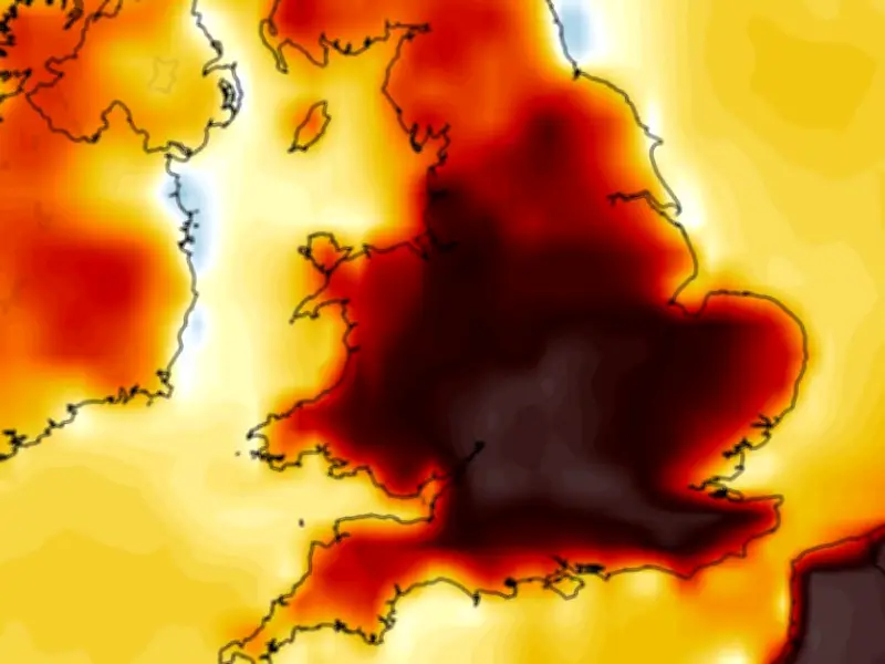
The GFS weather model now suggests temperatures could surge back as high as 36C again on the following weekend. On July 25 (Saturday) it shows highs of 34C and 35C in western England, with 33C coming in Wales, 34C in the Midlands, and 34C in the south-east. While on July 26 (Sunday) the data suggests highs of 36C are on the cards in the east of England. Temperatures could reach 34C/35C as far north as South Yorkshire, the maps show.
Temperature anomaly maps for that weekend show the UK shaded in areas of orange and red. This indicates where temperatures are expected to rise well above the seasonal average. In total, the GFS model maps show nine counties could see temperatures of 35C or above later this month. They are all in England.
Counties Facing 35C or More
- Yorkshire
- Nottinghamshire
- Lincolnshire
- Cambridgeshire
- Norfolk
- Suffolk
- Herefordshire
- Worcestershire
- Gloucestershire
Met Office Outlook: Above-Average Temperatures Persist
The Met Office also expects temperatures to remain above average as we head towards the end of July. However, the national weather agency says there will be an increased chance of thunderstorms. The Met Office forecast for July 19 to July 28 states: "Towards the latter part of July, the influence of high pressure may wane somewhat, allowing a greater chance of rain, showers or thunderstorms compared to earlier in the month. Overall, temperatures are expected to remain above average during this period."




