
The Atlantic hurricane season continues to intensify as meteorologists identify a new weather system rapidly developing into Tropical Storm Jerry. Located approximately 1000 miles east of the Leeward Islands, this storm is capturing the attention of weather experts across the globe.
Current Status and Projected Development
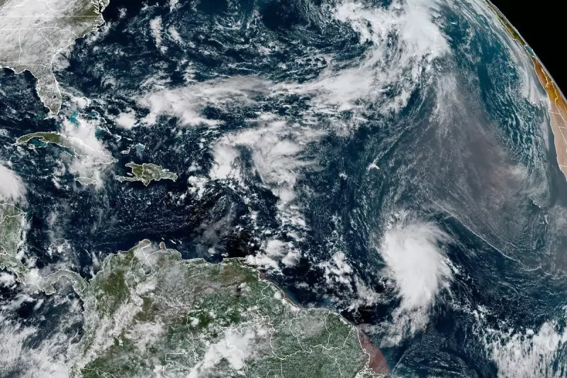
As of the latest advisory from the National Hurricane Centre, Tropical Storm Jerry is moving west-northwest at approximately 12 miles per hour. Maximum sustained winds have reached 40 mph, with meteorologists predicting significant strengthening over the coming 48 hours.
The critical question remains: Will Jerry escalate to hurricane status? Current models suggest the storm could reach hurricane strength by mid-week, presenting potential threats to Caribbean nations.

Potential Impact Zones and Preparedness
Weather authorities are closely monitoring several key areas that could be affected:
- The Leeward Islands face the earliest potential impact by late Wednesday
- Puerto Rico and the Virgin Islands may experience heavy rainfall and strong winds
- Eastern Caribbean nations are advised to review emergency preparedness plans
"Residents in potentially affected areas should closely monitor forecasts and have emergency kits prepared," advised a senior meteorologist at the National Hurricane Centre.
Broader Weather Patterns and Climate Context
This development occurs during what experts predict could be an above-average hurricane season. Warmer-than-usual ocean temperatures in the tropical Atlantic are contributing to favourable conditions for storm formation and intensification.
While the direct impact on the United Kingdom remains uncertain at this early stage, British meteorologists are tracking the system's progress, particularly regarding potential effects on transatlantic travel and weather patterns in the eastern Atlantic.
The Met Office continues to collaborate with international weather services to provide accurate forecasts for UK citizens travelling to potentially affected regions.


