The UK is set for a stark and frosty end to the year, with striking weather maps forecasting blizzards and a penetrating wind chill that could make it feel as cold as -6C on New Year's Eve. This marks a dramatic shift from the unseasonably mild conditions experienced in the lead-up to Christmas.
A Bitter Chill to Ring in the New Year
Forecasters warn that a surge of cold air moving in from Scandinavia will dominate the weather as 2025 draws to a close. The Met Office states it will "feel cold with a notable wind chill across England and Wales" during the festive period. This bitter sensation is due to fierce easterly winds, reminiscent of the so-called "Beast from the East," which will make temperatures feel significantly lower than the actual mercury reading.
On and around December 31, the wind chill is expected to be most severe in parts of the East of England and the Home Counties, including Buckinghamshire and Bedfordshire, where it could feel as frigid as -6C. Similarly harsh conditions are forecast for the evening in areas of Northeast England, such as County Durham.

Snow Maps Paint a Wintry Picture
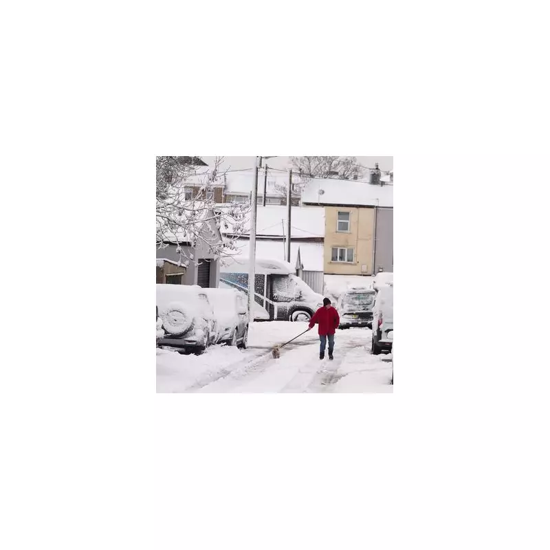
Weather maps from forecaster Metdesk support this chilly outlook, indicating snow is likely for eastern parts of the nation as the year changes. The data shows a band of wintry precipitation along the eastern coastline, stretching from Aberdeenshire in the north down to Suffolk in the south.
The heaviest blizzards, anticipated on the night of New Year's Eve, are forecast for East Yorkshire and Humberside. While it will be cold enough for snow across southern regions, revellers celebrating outdoors are more likely to encounter rain further west, including across the Midlands.
From Balmy to Biting: A Rapid Temperature Drop
This impending cold snap presents a sharp contrast to the recent mild spell. Earlier in the week, temperatures exceeded 12C in north Wales and across the Midlands. However, the BBC confirms that temperatures will begin falling steadily in the days after Christmas.
The Met Office forecast for the Christmas period indicates: "Cloud breaking through the Christmas period with more sunny spells emerging. Largely dry, but also feeling cold with a notable wind chill across England and Wales. Frosty by night." Another Metdesk map visualises this deep chill with dark blue hues covering the UK, darkest over the south and east.
Meanwhile, the aftermath of wetter weather continues, with several flood warnings and alerts in place over Christmas, mostly across Southwest England. Particular concerns exist for groundwater flooding in Hooke, Dorset, and at Curry Moor and Hay Moor in Somerset.