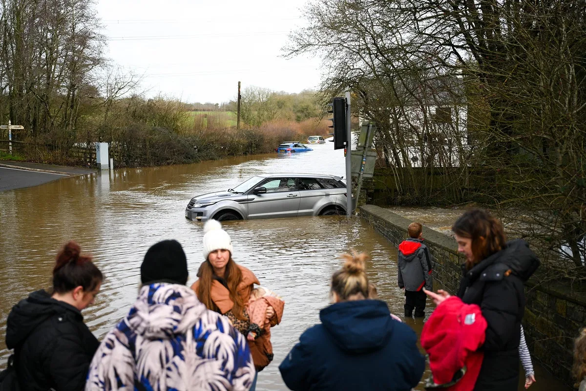
The Met Office has issued a series of fresh weather warnings for ice and heavy rain across several regions of the United Kingdom, as communities still reeling from the impacts of Storm Chandra brace for further disruption. With sodden ground and wet surfaces from recent flooding, the risk of icy conditions has escalated significantly, particularly in the southwest of England.
Ice Warnings in Force Across Multiple Regions
A yellow warning for ice is currently in effect for the entirety of the southwest, including Devon and Cornwall, as well as most of Wales and Northern Ireland. This warning, which remains active until 9am on Monday, highlights the potential for hazardous patches of ice on roads and pavements, increasing the risk of slips and accidents. Temperatures are forecast to drop below freezing overnight in these areas, transforming already wet surfaces into treacherous icy patches.
Heavy Rain and Flooding Threats Return
Following the ice warning, a separate yellow alert for heavy rain and possible flooding has been issued for the southwest, valid from midday on Sunday until 9am on Tuesday. The Met Office predicts significant rainfall accumulations, with 30-50mm expected over Dartmoor and 10-20mm widely across Devon, Cornwall, Dorset, and Somerset.
This persistent rainfall raises serious concerns about renewed flooding. The warning indicates a small chance that homes and businesses could be inundated, with fast-flowing or deep floodwater posing a potential danger to life. This comes just one week after Storm Chandra caused widespread disruption, forcing school closures and affecting an estimated 50 properties across Somerset communities like Ilminster, West Coker, Taunton, Mudford, and West Camel.
Meteorologist Urges Public Caution
Met Office meteorologist Kathryn Chalk has emphasised the need for vigilance in the face of these compounding weather threats. "There is already a yellow rain warning in force, so we could see further disruption and more flooding," she stated. "So do take care, and do keep an eye on the forecast for this if you're based in the southwest."
Chalk further explained that temperatures will feel particularly chilly, especially in northern and eastern regions, with highs reaching only 10 or 11 degrees Celsius. The forecast indicates that frost and icy conditions are likely on Monday morning, accompanied by mist and fog, before more rain arrives later in the day.
Extended Weather Outlook
The Met Office's five-day forecast suggests continued unsettled conditions across the UK:
Sunday: A rather cloudy day with outbreaks of rain for most areas, some heavy and showery across Wales and western regions. Rain will move eastwards through the day, leaving clearer spells in the west later.
Sunday night: Cloud and rain continue moving eastwards, with many areas staying cloudy. Clear spells in the west will lead to frost and fog patches, before cloud returns to the southwest later.
Monday: A cloudy start for many with outbreaks of light rain and showers. The southwest will be dry initially, but more persistent rain is expected to move in later.
Tuesday to Thursday: Conditions remain unsettled with showers or longer spells of heavy rain affecting most areas, accompanied by brisk winds at times. Further snow is anticipated on northern hills, with below-average temperatures persisting in northern regions.
The combination of ice warnings following recent flooding creates a particularly hazardous situation for transportation and local communities. Authorities are urging residents in affected areas to exercise extreme caution, monitor local updates, and prepare for potential travel disruption as these weather systems move across the country.