
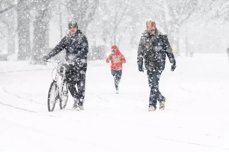
A significant winter weather system is poised to impact a vast portion of the United States beginning on Friday, delivering a combination of heavy snowfall, ice accumulation, and dangerously low temperatures across nearly 2,000 miles from the south-western regions to the eastern seaboard.
Extensive Geographic Reach and Population Impact
This expansive storm is forecast to affect more than 200 million residents, disrupting daily life and infrastructure on a massive scale. The system's path will encompass numerous major metropolitan areas, creating widespread challenges for communities and emergency services.
Timeline and Progression of the Weather Event
Meteorological models indicate the storm will first develop in the Rocky Mountains and Plains on Friday before advancing steadily eastward throughout the weekend. The system is not expected to relinquish its hold on the eastern coastal regions until early next week, prolonging the period of hazardous conditions.

Initial impacts will be felt in cities including Denver, Albuquerque, Wichita, and Oklahoma City, with accumulating snow predicted for parts of Wyoming, Colorado, and New Mexico. By Saturday, the storm's influence could simultaneously affect over 100 million people across multiple states.
Varied Precipitation Types and Accumulation Forecasts
Different regions will experience distinct precipitation patterns, with some areas along the storm's trajectory potentially receiving more than a foot of snow. A broad zone extending from northern Texas through Kentucky may see average snow accumulations of 6 to 12 inches.
Meanwhile, southern regions face the threat of a dangerous ice storm stretching from Texas into the Carolinas, creating particularly hazardous travel conditions along major highway networks. The combination of freezing rain and ice accumulation poses significant risks to transportation infrastructure and power distribution networks.
Extreme Cold and Polar Vortex Influence
What makes this weather system especially perilous is the accompanying extreme cold air mass, driven by a southward plunge of the polar vortex. Temperatures in parts of the midwest, Great Lakes, and New England regions are forecast to plummet below minus 30 degrees Fahrenheit.
This frigid air will collide with moisture flowing from both the Pacific Ocean and the Gulf of Mexico, creating conditions for what meteorologists are describing as potentially the most powerful winter storm of the current season. The cold temperatures are expected to linger even after the precipitation subsides.
Peak Intensity and Simultaneous Impact
Forecasters anticipate the storm will reach its peak intensity on Sunday, when approximately 55% of the population in the contiguous United States will be experiencing some form of winter precipitation simultaneously. This includes snow, sleet, and freezing rain across multiple time zones.
On Sunday, the storm's core is predicted to shift toward the eastern seaboard, with the heaviest snowfall likely centered over the mid-Atlantic region. Cities including Washington and Baltimore could experience major snow accumulations before the system finally moves offshore late in the day.
Infrastructure Risks and Safety Preparations
The combination of heavy precipitation, ice accumulation, and gusty winds of 20 to 30 miles per hour creates multiple infrastructure threats. These conditions could lead to downed trees and power lines, resulting in prolonged power outages across affected regions.
Residents in the most vulnerable areas have been advised to undertake comprehensive preparations, including fueling backup generators, securing necessary medications, and stocking adequate supplies of water and non-perishable food items. The potential for blowing snow and ice-coated branches adds to the hazards.
Expert Analysis and Historical Context
Defense department meteorologist Eric Webb commented on the developing situation, noting on social media platform X that "We're about to witness a truly legendary winter storm setup in the Southern US later this week," describing the system as containing "a ridiculous amount of snow/ice."

The storm's eventual reach is expected to extend into the Great Lakes and New England regions, affecting cities including Pittsburgh, Cleveland, Buffalo, and Boston. Some snowfall may persist across parts of the north-eastern United States even after the main system moves offshore.


