
The Atlantic Ocean has unleashed a meteorological beast as Hurricane Lee rapidly intensified into a formidable Category 5 storm, sending weather officials across the Caribbean into high alert. The powerful hurricane continues to gain strength while charting a course that could bring devastating conditions to several island nations.
Record-Breaking Intensification Stuns Meteorologists
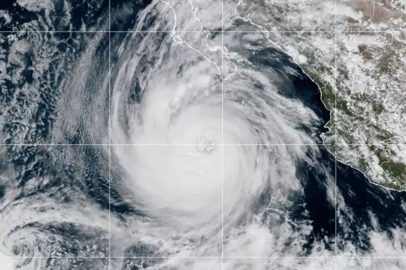
Meteorologists have watched in awe as Lee underwent what experts call "explosive intensification," transforming from a tropical storm into a catastrophic Category 5 hurricane in record time. The storm's maximum sustained winds have skyrocketed to an alarming 160 mph (257 km/h), placing it among the most powerful Atlantic hurricanes in recent memory.
"We're witnessing a truly remarkable and dangerous meteorological event unfold," stated one senior forecaster from the National Hurricane Center. "The rapid strengthening we've observed with Lee is every forecaster's nightmare scenario."

Caribbean Islands Brace for Impact
While the exact trajectory remains uncertain, weather models indicate the Leeward Islands face the most immediate threat from Lee's outer bands. Emergency preparations are underway across the region as residents stock up on essential supplies and reinforce properties against the impending onslaught.
The hurricane's current path suggests it may pass north of the Caribbean islands, but officials warn that even a slight deviation could bring catastrophic consequences to populated areas.
Dangerous Conditions Extend Far From Centre
Meteorological authorities emphasize that Lee's destructive potential extends well beyond its eye. The massive storm is generating:
- Life-threatening surf and rip current conditions
- Powerful swells affecting beaches hundreds of miles away
- Tropical storm-force winds extending 140 miles from the centre
- Torrential rainfall capable of triggering flash flooding
Uncertain Long-Term Trajectory Keeps Forecasters Guessing
Beyond the immediate Caribbean threat, weather models show considerable disagreement about Lee's future path. Some projections indicate the hurricane may curve northward, potentially affecting Bermuda and eventually the eastern seaboard of the United States.
"The atmospheric steering patterns remain complex and uncertain," explained a senior hurricane specialist. "While the Caribbean faces the most immediate danger, residents along the entire US eastern coastline should monitor Lee's progress closely in the coming days."
Emergency management agencies across multiple jurisdictions have activated their hurricane response teams, preparing for what could become one of the most significant weather events of the 2023 Atlantic hurricane season.


