
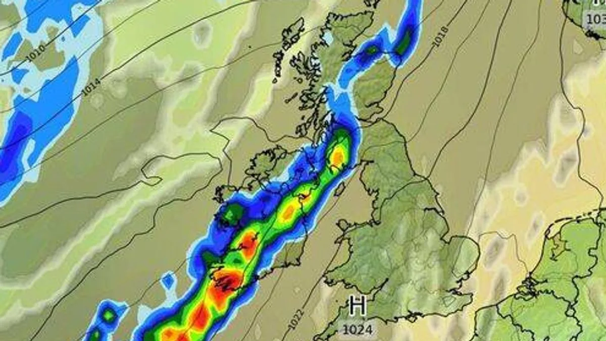
A colossal 880-mile storm is forecast to hit the UK on Saturday, September 27, bringing 70mph winds and heavy rain. Weather maps indicate the storm will affect areas from Land's End in southwest England to Fraserburgh in northeast Scotland, as well as the west coast and north of Wales, the Midlands, parts of southern and northern England, central and southern Scotland, and Northern Ireland.
The Met Office's forecast for September 24 to October 4 suggests that the settled weather of previous days will continue, with most days dry, light winds, and sunny spells. However, there is a risk of mist or isolated fog patches overnight, and thicker cloud and outbreaks of rain may already affect the extreme northwest.
Experts warn that over the coming weekend, there will be a steadily increasing chance of this rain moving eastwards across more of the UK, with eastern areas expected to fare best. The forecaster added that confidence in any breakdown to unsettled weather is very low, influenced by ex-Hurricane Gabrielle, which may approach the UK during this time.

The following week will most likely see a west-to-east split, with the wettest weather remaining in western areas and temperatures around to above average. The BBC reported that Tuesday and Wednesday will be largely dry with variable cloud and sunny spells, turning breezier in the northwest, while Thursday will be similar with temperatures increasing a little.
This storm follows recent flooding chaos that battered parts of the UK, including the M62 near Huddersfield and Salford, where an entire street disappeared underwater after flood warnings were issued across Greater Manchester.


