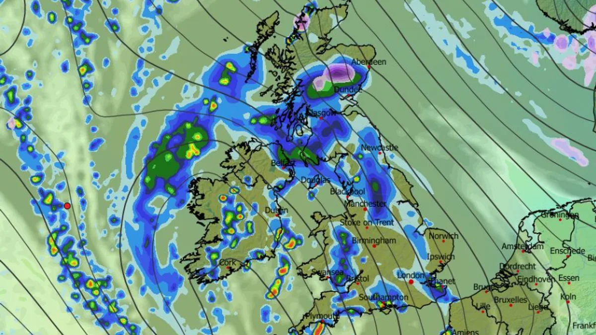
The Met Office has issued a stark warning to residents across 32 areas of the UK, urging them to consider preparing an emergency kit ahead of a significant deluge expected next week. A fresh yellow weather warning for rain is in place, with forecasts predicting up to 100mm of rainfall in some regions, posing a potential danger to life.
Severe Weather Warning Details
The national weather service has activated the warning from 6pm on Monday until 6pm on Tuesday. The alert covers extensive parts of south-west England and Wales, where the ground is already saturated from previous rainfall. The Met Office anticipates widespread accumulations of 20-40mm, with 60-80mm likely over Dartmoor and the high ground of south Wales.
There is a small chance that the most exposed hills could see a staggering 80-100mm of rain. This volume of water falling on wet ground significantly increases the risk of flash flooding, transport chaos, and community isolation.
Potential Impacts and Official Advice
The warning spells out serious potential consequences. Flooding is expected to cause road closures and cancellations to train and bus services. There is also a noted risk that some rural communities could be temporarily cut off. Buildings and businesses face potential flood damage, and there is a small chance that fast-flowing or deep floodwater could pose a danger to life.
Power cuts are also considered likely. In response, the Met Office is advising people in flood-prone areas to take proactive steps. Their guidance is clear: "People cope better with power cuts when they have prepared for them in advance. It’s easy to do; consider gathering torches and batteries, a mobile phone power pack and other essential items."
Areas Under the Warning and Looking Ahead
The regions covered by the yellow warning are extensive. In England, the list includes Hampshire, Bristol, Cornwall, Devon, Dorset, Gloucestershire, Somerset, Wiltshire, and Herefordshire, among others. In Wales, the warning spans from Cardiff and Swansea to Pembrokeshire, Ceredigion, and Powys.
Looking further into December, the Met Office's longer-range forecast suggests unsettled conditions will dominate after mid-month. Low-pressure systems are expected to bring further showers and longer spells of rain, particularly to western parts of the UK, with snow likely confined to northern high ground.
For now, the immediate advice is for residents in the affected areas to prepare, stay informed, and amend travel plans if necessary. Checking road conditions and public transport timetables before setting out next week could be crucial to avoiding severe disruption.