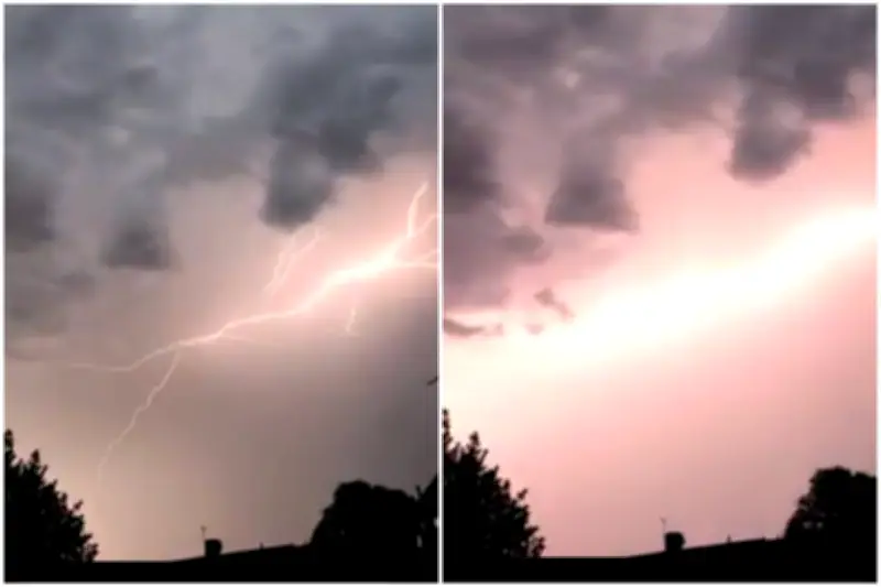
Spectacular thunderstorms swept across London overnight, generating thousands of lightning strikes and triggering flash floods that submerged roads and disrupted transport. The storms battered the capital for more than two hours, waking thousands as torrential rain filled streets with water.
Unexpected Storm Cell
The thunderstorm cell erupted overnight, catching forecasters by surprise. Londoners shared stunning video clips of lightning observed across all corners of the capital. “I’ve not seen anything like this in years in London,” wrote one person on X, posting videos of flash floods in Ruislip, west London. Another X user added: “The whole road from the Polish War Memorial up to Ruislip was basically under water. Ruislip Manor station also flooded.”
Flooded roads were also reported in Uxbridge and Raynes Park. The Met Office had not issued a warning for thunderstorms, highlighting the sudden nature of the event.

Heatwave Intensifies
The storms come as a heatwave builds over London, with temperatures expected to approach 40°C in the coming days. Transport bosses have warned against all but essential travel amid rare red warnings over extreme heat, which could set record highs for June. Temperatures are likely to surpass the June record set in Hampshire in 1976 by several degrees and could come close to the UK’s all-time high of 40.3°C recorded in July 2022.
The Met Office warned that the hot conditions, accompanied by high humidity and very warm nights, will make it hard for people to recover overnight. A red weather warning for extreme heat covering an area from London to Swansea and Somerset to Birmingham is in effect from 9am Wednesday to 9pm Thursday. These warnings are reserved for the most severe events, expected to bring “severe and significant impacts” including widespread health risks and even danger to life.
School Closures
Scores of schools across England and Wales announced they would close or finish early later this week to protect pupils amid the extreme heat.