A long-simmering territorial dispute between Thailand and Cambodia has flared up once again, with its roots buried deep in history, colonial cartography, and the sacred stones of ancient temples. At the heart of the conflict lie century-old maps and a revered Hindu temple complex, Preah Vihear, which have become symbols of national pride and sovereignty for both nations.
The Cartographic Legacy of Colonial Rule
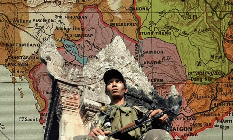
The modern border conflict is inextricably linked to maps drawn during the era of French colonial administration in Indochina. A key document is a map, part of a series produced by French surveyors between 1905 and 1907, which was subsequently endorsed by a bilateral treaty. This map placed the Preah Vihear temple complex squarely within Cambodian territory.
Thailand, then known as Siam, initially contested this delineation. However, the matter was brought before the International Court of Justice (ICJ) in The Hague. In a landmark 1962 ruling, the court awarded sovereignty of the temple to Cambodia, basing its decision primarily on Thailand's failure to object to the map for decades and its implied acceptance. Crucially, the court's judgement pertained specifically to the temple precincts, leaving the surrounding land border area less clearly defined, a ambiguity that has fuelled tension ever since.
Preah Vihear: A Sacred Site on a Contested Cliff
Preah Vihear is not merely a piece of land; it is an 11th-century Hindu temple dedicated to the god Shiva, built by the Khmer Empire. Perched dramatically on the edge of a cliff in the Dângrêk Mountains, it is a site of immense archaeological, spiritual, and cultural significance. Its listing as a UNESCO World Heritage Site for Cambodia in 2008 acted as a major catalyst for renewed military and diplomatic clashes.
Thailand viewed this unilateral listing as provocative, leading to a series of deadly military skirmishes between 2008 and 2011 that caused casualties and displaced thousands of civilians on both sides. The temple's strategic location, offering commanding views over the Cambodian plains, adds a layer of military significance to its historical and religious value.
The Ongoing Friction and Diplomatic Stalemate
Despite the 1962 ICJ ruling and subsequent orders for both sides to withdraw troops from a provisional demilitarised zone, the area remains a flashpoint. Periodic troop buildups, accusations of encroachment, and nationalist rhetoric from both Bangkok and Phnom Penh keep the dispute alive. The conflict is often stoked by domestic political pressures, where patriotic defence of territory resonates powerfully with the public.
Efforts to resolve the broader border demarcation have progressed slowly. A joint commission has worked on surveying and marking the frontier, but progress is painstaking and frequently interrupted by political tensions. The underlying issue remains a clash between a historical, map-based boundary and modern assertions of territorial integrity.
The visual evidence of the old French maps, contrasted with satellite imagery and modern surveys, clearly illustrates the source of the disagreement. They show how a line drawn by colonial officials over a century ago continues to shape geopolitics in Southeast Asia today, proving that in this region, history is never truly past.