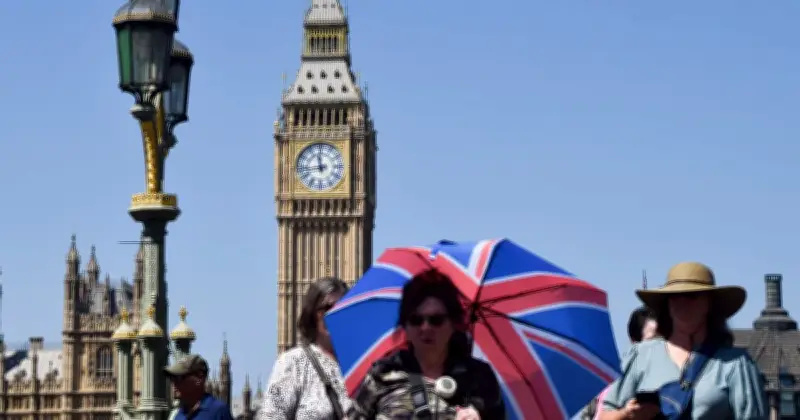
Britain is enduring its third heatwave of the summer, with Met Office weather maps showing volcanic red across England and Copernicus models indicating a significant rise in temperature trends. Forecasters predict highs of 35°C or even 36°C in the hottest spots on Thursday and Friday, with 33-34°C possible more widely across southern and eastern areas.
Record-Breaking June Heat
The current surge follows record-smashing heat in June. According to the Copernicus Climate Change Service (C3S), implemented by the European Centre for Medium-Range Weather Forecasts (ECMWF), June 2026 was the hottest on record for western Europe and the second warmest globally. Western Europe logged its warmest June ever, with an average of 20.74°C — a staggering 3.05°C above the 1991-2020 norm.
The UK experienced extreme heat in the second half of June, contributing to new national records, including a scorching 37.7°C in Lingwood, Norfolk. That heatwave, which followed an intense May burst and preceded the July resurgence, broke monthly and all-time records across several countries. It was fuelled by record sea surface temperatures — the highest for June in extra-polar oceans — and strong El Niño conditions developing in the Pacific.
Climate Warnings
Samantha Burgess, strategic lead for Climate at ECMWF, warned: “June 2026 underscored how profoundly the climate is changing. The result is increasingly intense heatwaves, a persistently warm ocean, and growing risks for people, ecosystems and infrastructure.” The succession of extremes highlights a troubling trend: heatwaves are becoming more frequent and severe.
Dry soils across western and central Europe, worsened by the back-to-back events, have stoked wildfire risks in the Iberian Peninsula and southern France while heightening drought concerns further east. River flows remain below average in many areas.
Current Heatwave Details
As July unfolds, the UK is feeling the heat again. The Met Office has confirmed heatwave conditions in parts of the south-east since early in the month, with the third spell of the year intensifying mid-week. Temperature maps show deep reds signalling 30°C+ across large swathes, particularly in England. London and the south-east could hit 34°C, while forecasters eye 35-36°C peaks further afield in the coming days before a slight easing.
Health Impacts and Alerts
Health impacts are a major concern. The UK Health Security Agency has issued amber alerts, urging the public — especially the elderly and those with pre-existing conditions — to stay hydrated, seek shade, and check on vulnerable neighbours. Previous heatwaves this summer have already been linked to health strains and even deaths.
Europe-wide, the pattern reflects a climate system accumulating heat at an alarming rate. Global June surface air temperatures were 0.56°C above the 1991-2020 average, while sea surface temperatures set a new June high.
Outlook
Meteorologists note that while individual events cannot be pinned solely on climate change, the odds of such extremes have risen sharply due to human influence. Long-range outlooks had signalled a warmer-than-average summer, with increased chances of heat spikes. High pressure will keep conditions settled into next week, though temperatures may trend down slightly after the peak. Northern areas and western fringes are likely to see more variation, with some wetter spells possible.
As maps glow red once more, the message from scientists is stark: these are not isolated anomalies — they are the new normal in a warming world. With El Niño strengthening and oceans holding record heat, Europe and the UK must brace for more of the same. Hydration, cooling measures, and awareness of the risks will be essential in the days ahead.