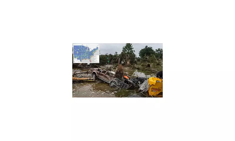
A newly released map has unveiled the most disaster-prone regions in the United States, as well as the safest areas where residents face minimal threats from natural calamities. The comprehensive analysis provides crucial insights for Americans looking to relocate or better understand the risks in their current locations.
America's Danger Zones Exposed
The map identifies several key areas as high-risk zones for multiple natural disasters:
- The Gulf Coast: Regularly battered by hurricanes and prone to severe flooding
- California: At constant risk from earthquakes, wildfires, and droughts
- Tornado Alley: The Midwest remains vulnerable to devastating twisters
- Pacific Northwest: Threatened by volcanic activity and seismic events
Safe Havens Across the Nation
For those seeking refuge from natural disasters, the map highlights several relatively safe regions:

- New England: Particularly inland areas of Vermont, New Hampshire, and Maine
- Upper Midwest: Including parts of Minnesota and Wisconsin
- Intermountain West: Such as Utah and Colorado (excluding wildfire zones)
What Makes These Areas Safer?
The safest regions generally benefit from:
- Geographic distance from coastal storm systems
- Stable geological foundations
- Moderate climate patterns
- Lower population density reducing human-made risks
Climate Change Impact
Experts warn that these risk assessments may shift in coming decades as climate change alters weather patterns and increases the frequency of extreme events. Areas once considered safe might face new threats, while current danger zones could see intensified risks.
Planning for the Future
The map serves as both a warning and a planning tool for:

- Homebuyers considering long-term investments
- Businesses assessing operational risks
- Emergency services preparing response strategies
- Policy makers developing infrastructure plans