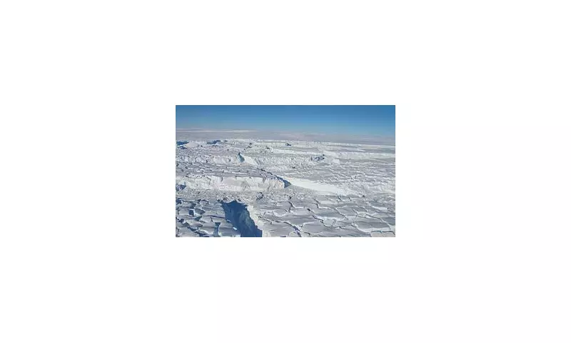
For the first time, scientists have produced the most comprehensive map of the mysterious world hidden beneath Antarctica's colossal ice sheet, revealing a dramatic landscape of mountains, valleys, and plains that has been sculpted over millions of years.
Peering Through Miles of Ice
Antarctica's ice sheet, covering a staggering area of almost 14 million square kilometres, is the largest single mass of ice on our planet. Yet, until now, researchers have understood more about the surfaces of Mars and Venus than the terrain concealed beneath this frozen expanse. The difficulty of observing through ice has left vast regions uncharted.
An international research team, led by experts from the University of Edinburgh, has now broken through this barrier. They combined a novel mapping technique with cutting-edge satellite data to create an unprecedented view of the entire continent's subglacial topography.

A Landscape of Hills, Mountains and Canyons
The new map uncovers thousands of previously unknown features. It details a varied terrain consisting of subglacial hills and valleys, extensive mountain ranges, and deep canyons, all buried under miles of ice.
'Over millions of years Antarctica's ice sheet has sculpted a landscape consisting variously of flat plains, dissected plateaus and sharp mountains, all hidden under the present miles-thick ice cover,' explained co-author Professor Robert Bingham from the University of Edinburgh's School of GeoSciences. 'With this technique we are able to observe for the first time the relative distributions of these highly variable landscapes over the whole continent.'
The key to this discovery is a method called Ice Flow Perturbation Analysis (IFPA). This technique identifies characteristic shapes on the glacial surface that are generated as ice flows over the hidden hills and valleys beneath. By merging IFPA data with satellite observations, the team filled critical gaps in knowledge, even in the most remote regions.
Crucial Insights for Future Sea Level Rise
The findings are far more than a geological curiosity; they provide vital intelligence for predicting how Antarctica's ice will respond to climate change. The ice sheet is already retreating and thinning due to warming oceans and air.
'Understanding the landscape beneath Antarctica is really important for ice-sheet models,' said Mathieu Morlighem from Dartmouth College, US. 'In particular, rougher areas with more hills can really slow down the retreat of the ice sheet, and so this new map will help our models to produce better projections of where and how much sea levels will rise in the future.'
Lead author Dr Helen Ockenden highlighted the breakthrough: 'Because making scientific observations through ice is difficult, we know less about the landscape hidden beneath Antarctica than we do about the surface of Mars or Venus. So it's really exciting that this new method allows us to use satellite measurements of the ice surface to fill all of the gaps in our maps, revealing new details about mountain ranges, canyons and geological boundaries.'
The map now serves as an essential guide, showing scientists where to focus future surveys. It will directly contribute to developing more accurate projections of global sea level rise, a critical threat to coastal communities worldwide. The research has been published in the prestigious journal Science.