
The ghost of Hurricane Humberto is preparing to unleash its fury on British shores, transforming from tropical tempest to a formidable Atlantic storm that could disrupt travel and bring flooding to vulnerable areas.
When Will the Storm Hit?
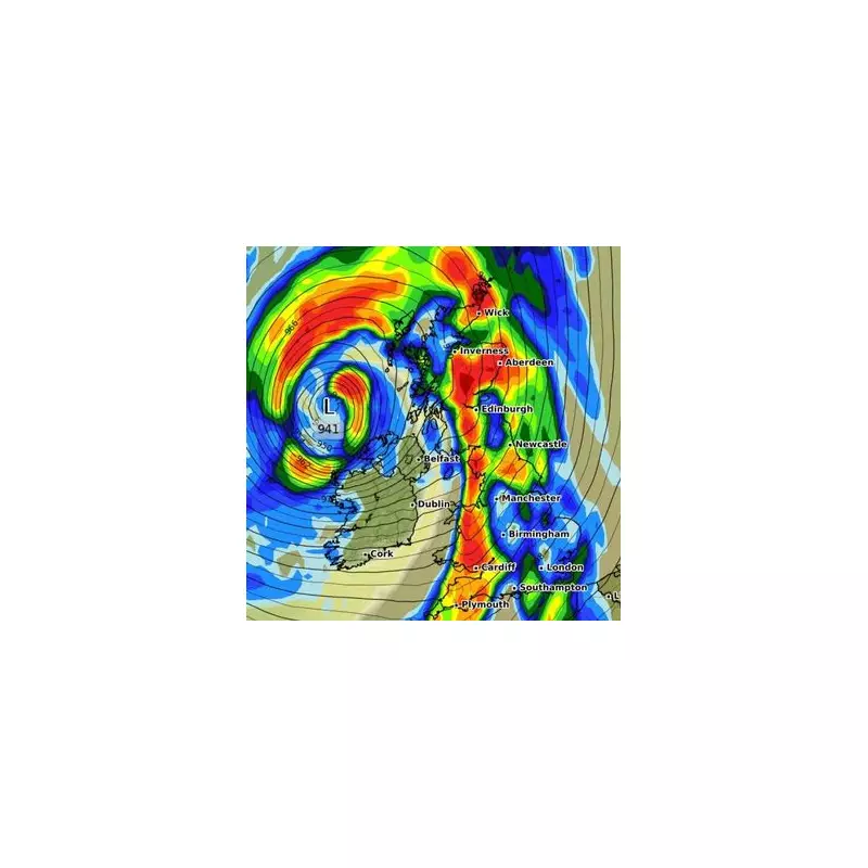
Weather experts are tracking the system's precise trajectory, with the most significant impacts expected to batter the UK throughout Tuesday and Wednesday. The Met Office has already raised yellow weather warnings for rain across southwestern regions, indicating potential travel chaos and localised flooding.
Which Regions Face the Greatest Threat?
Current models suggest Wales and southwestern England will bear the initial brunt of Humberto's remnants. These areas could experience:

- Torrential downpours exceeding 40mm in some locations
- Powerful gusts reaching 50mph along coastal communities
- Possible transport delays and road closures
- Localised flooding in low-lying areas
From Caribbean to British Shores
Humberto's journey began as a powerful hurricane in the Atlantic, eventually transitioning into a post-tropical cyclone. While it's lost its hurricane status, the storm retains considerable energy that will interact with existing weather systems approaching from the Atlantic.
Protecting Your Property and Travel Plans
Residents in warning areas should take precautions by securing loose outdoor items and monitoring flood alerts. Travelers should check conditions before embarking on journeys, particularly in western regions where conditions could deteriorate rapidly.
The Met Office continues to monitor the situation closely, with updates expected as the storm's path becomes more defined. While not unprecedented, these post-tropical systems serve as a reminder that hurricane season thousands of miles away can still impact British weather patterns.


