
Britain is bracing for a dramatic weather shift as new storm maps reveal a colossal 500-mile 'rain bomb' preparing to unleash torrential downpours across the nation. The Met Office has issued urgent warnings as this weather system threatens to bring widespread disruption.
When Will the Storm Hit?
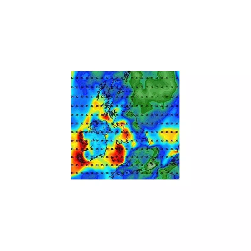
The deluge is expected to make landfall on Wednesday, with the worst conditions predicted between 6pm and midnight. Satellite imagery shows the enormous weather front stretching from the southwest to northeast England, covering nearly the entire length of the country.
Areas at Highest Risk
Forecasters have identified several regions particularly vulnerable to flooding:

- South West England
- Wales
- North West England
- Parts of Scotland
The Environment Agency has already activated flood alerts in these areas, urging residents to prepare for possible evacuations.
How Much Rain Are We Talking About?
Meteorologists predict some regions could see up to 40mm of rainfall in just a few hours - nearly half the average monthly rainfall for October. The intense precipitation is being caused by a combination of factors:
- A deep Atlantic low-pressure system
- Unusually warm sea temperatures
- A strong jet stream steering the storm directly toward the UK
Travel Chaos Expected
Transport networks are preparing for significant disruption:
Roads: Spray and sudden flooding could create dangerous driving conditions, with motorists advised to avoid non-essential journeys.
Rail: Speed restrictions may be imposed on some routes, leading to delays and cancellations.
Air: Some flights may face delays due to reduced visibility and strong crosswinds.
Is This Linked to Climate Change?
While no single weather event can be directly attributed to climate change, scientists note that extreme rainfall events are becoming more frequent and intense in the UK. The Met Office's State of the UK Climate report shows that the most recent decade was 9% wetter than 1961-1990.
Stay tuned for updates as this developing weather situation unfolds across Britain.


