
The United Kingdom is preparing for a sharp cold snap as the Met Office has issued yellow weather warnings for snow and ice across significant portions of the country. An Arctic airmass is set to bring dramatically lower temperatures and potential travel disruption.
Freezing Conditions Spread Southwards
Meteorologists warn that northern Scotland and parts of northern England will bear the initial brunt of the freezing conditions starting Wednesday. The cold front is expected to push southwards throughout the week, affecting much of the UK with temperatures dropping well below seasonal averages.
"We're looking at a notable change in weather patterns," explained a Met Office spokesperson. "The mercury could plunge to -10°C in sheltered Scottish glens, with widespread overnight frosts becoming increasingly common across the nation."

Travel Disruption Likely
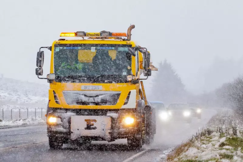
The weather authority has specifically highlighted risks to travellers, particularly those in affected regions. Icy patches are expected to form on untreated roads, pavements, and cycle paths, creating hazardous conditions for commuters and pedestrians alike.
Areas under yellow warnings should prepare for:
- Dangerous driving conditions due to ice formation
- Potential public transport delays
- Increased risk of slips and falls on frozen surfaces
- Possible rural community isolation in hardest-hit regions
Short-Lived Cold Spell
While the Arctic blast will deliver a significant temperature shock, forecasters indicate the cold spell may be relatively brief. Current models suggest a return to milder, more unsettled conditions by the weekend, though this transition could bring its own challenges with potential rain and stronger winds.
The Met Office continues to monitor the situation closely and advises the public to stay updated with the latest forecasts as the week progresses.


