Residents across parts of northwest England were given a startling wake-up call late on Wednesday night as a 3.3-magnitude earthquake shook their homes. The tremor, which struck shortly after 11.23pm, was felt across Lancashire and the southern Lake District, sending a wave of alarm through local communities.
The Night the Ground Moved in Lancashire
According to the British Geological Survey (BGS), the epicentre of the quake was located just off the coast of Silverdale, Lancashire, at a depth of approximately 1.86 miles. The towns of Kendal and Ulverston, within a 12-mile radius, reported feeling the distinct shaking.
On social media, locals described the unsettling experience. Lynn Snowdon posted on a Carnforth community page: "What the hell was that? House just shaken like a leaf?" Another resident from Over Kellet provided a vivid account: "It felt like my whole house moved side to side and everything inside just shook... Very scary."

Emergency services were alerted, with Lancashire Police initially receiving reports of a loud explosion in the Carnforth area. They later confirmed the cause was a minor earthquake. Fortunately, there were no reports of injuries or significant structural damage.
Britain's Seismic Landscape: More Active Than You Think
While last night's event caused a stir, it is far from an isolated incident in the British Isles. The BGS detects between 200 and 300 earthquakes in the UK annually, though only 20 to 30 are typically strong enough to be felt by the public. The nation has a long history of notable tremors, some of which have caused considerable damage.
Five of Britain's Most Significant Earthquakes
Dogger Bank, 1931: This remains the largest recorded British earthquake, registering a powerful 6.1 on the Richter scale. Its epicentre was in the North Sea, about 60 miles off the English coast. Despite the distance, damage was reported in 71 locations. In Filey, North Yorkshire, a church spire was twisted, chimneys collapsed in eastern towns, and a woman in Hull sadly died from a heart attack thought to be triggered by the event.
Derby, 1957: Striking on February 11, this magnitude 5.3 quake caused significant masonry and roof damage across the Midlands. Centred near Castle Donington, its effects were felt as far away as Norwich. One boy suffered a fractured skull from falling debris.
Llŷn Peninsula, 1984: North Wales, the UK's most seismically active region, experienced the strongest quake of the 20th century here on July 19. Measuring 5.4, it shook residents in Porthmadog out of bed and was felt nationwide, causing power cuts and building damage. In Liverpool, two elderly women were treated for shock after chimney pots crashed through their roof.
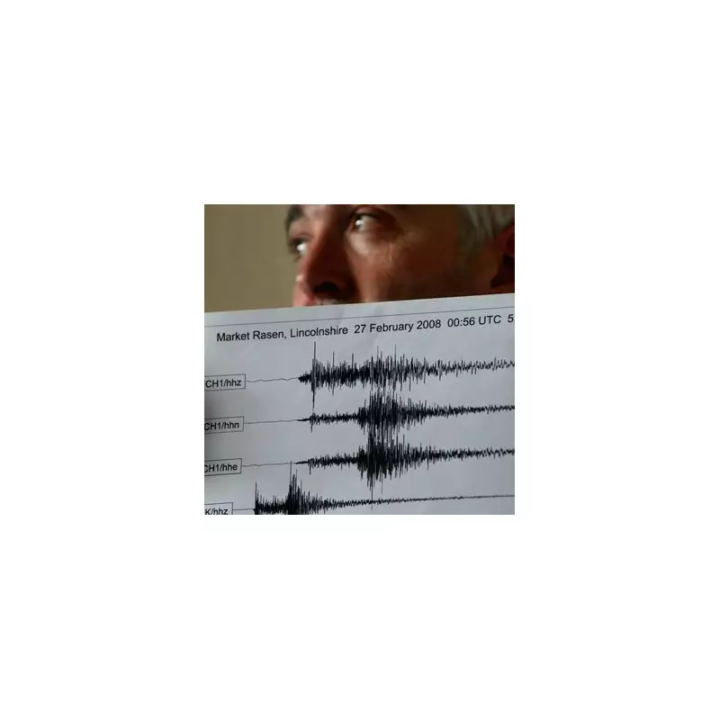
Market Rasen, 2008: To date, this is the strongest UK earthquake of the 21st century, with a magnitude of 5.2. Its impact was remarkably widespread, felt from Northern Ireland to the Isle of Wight. Insurers paid out around £30 million for damage. In a harrowing incident in Barnsley, 19-year-old student David Bates suffered a broken pelvis when a chimney pot fell through his roof.
Understanding the Risk and Reaction
The recent Silverdale event, while frightening for those who experienced it, underscores the typically low-intensity nature of British seismicity. The BGS's extensive monitoring network continues to provide crucial data, helping scientists understand the fault lines that crisscross beneath the UK.
For residents, the sudden jolt serves as a rare reminder of the dynamic geological forces at work, even on a seemingly stable island. The swift response and confirmation from authorities like Lancashire Police and the BGS also highlight the established protocols for managing such unexpected natural events.