The United Kingdom is on high alert as Storm Goretti barrels in, threatening to unleash a ferocious 'weather bomb' of heavy snow and destructive gale-force winds. The Met Office has issued a cascade of severe weather warnings across the nation, with the south-west of England expected to bear the brunt of the onslaught.
What is a 'Weather Bomb'?
The incoming tempest has been classified as a 'multi-hazard event' by forecasters, with the potential to cause significant disruption. The term 'weather bomb', or explosive cyclogenesis, refers to a rapid and intense drop in atmospheric pressure. For a storm to earn this dramatic label, the central pressure must plummet by at least 24 millibars within 24 hours. According to meteorological data, Storm Goretti is set to far exceed this threshold, with a predicted pressure drop of 36 millibars between 6pm on Wednesday and 6pm on Thursday.
Amber and Yellow Warnings in Force
A severe amber wind warning is active from 4pm to 11pm for Cornwall and the Isles of Scilly, where gusts could reach a terrifying 100 miles per hour. The Met Office has warned that winds of this magnitude are 'strong enough to bring down trees and cause structural damage'. A broader yellow wind warning covers the entire south coast, with gusts forecast up to 60mph.

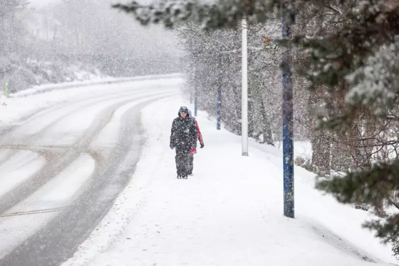
Simultaneously, an amber warning for snow is in effect from 8pm Thursday until 9am Friday, covering parts of Wales, the Midlands, and South Yorkshire. Forecasters predict that rain will turn to heavy snow, potentially isolating some rural communities. Accumulations of 10-15cm are widely expected, with up to 30cm possible on higher ground in Wales and the Peak District.
Widespread Disruption Expected
Further yellow warnings for snow and ice extend the risk across a vast swathe of the country. A snow warning runs from 5pm Thursday to noon Friday for an area stretching from Northumberland to Wiltshire, while a separate snow and ice warning covers Scotland from 10pm Thursday until noon Friday.
The combination of these hazards is predicted to create dangerous travelling conditions and widespread disruption. Authorities are urging the public to stay informed via the latest Met Office updates, avoid unnecessary travel in warning areas, and prepare for potential power outages and transport cancellations. The storm, named by French forecaster Météo-France, serves as a stark reminder of the UK's vulnerability to rapidly intensifying Atlantic weather systems.