
Britain is bracing for a significant wintry onslaught as the latest meteorological data indicates two separate Arctic weather fronts are poised to sweep across the country, bringing substantial snowfall to several major urban centres. Advanced modelling from the GFS charts a dramatic drop in temperatures and the arrival of intense snow showers starting next week.
First Snow Front: Timeline and Impact Areas
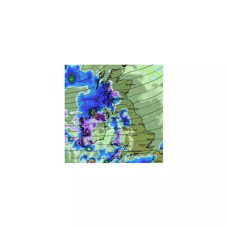
The initial blast of winter weather is scheduled to make landfall on the evening of Wednesday, December 17. According to the detailed maps, the first flurries are expected to hit Northern Ireland at around 9pm, quickly followed by snow across western parts of Scotland, Wales, and the south-west of England.
As the system pushes eastwards overnight, the focus will shift by 3am on Thursday, December 18. Forecast models suggest heavy snowfall will become concentrated over a large portion of Scotland and the north-west of England. Glasgow is highlighted for particularly intense snow, while Blackpool also finds itself directly in the firing line during these early hours.

Second Wave and Widespread Accumulation
The cold snap is set to intensify with a second, powerful weather front moving in during the afternoon of December 18. This system is predicted to deliver a further mix of snow and rain, renewing the wintry hazard for the north-west. Manchester, Liverpool, and Blackpool could all see fresh snowfall around 3pm. Simultaneously, parts of Wales and southern Scotland are also forecast to experience heavy snow.
By the morning of Friday, December 19, the cumulative effect of these Arctic blasts will be fully visible. Snow coverage maps indicate settled snow could be on the ground across all of Northern Ireland, including Belfast. In Scotland, residents in Aberdeen, Dundee, Glasgow, and Edinburgh should prepare for significant disruption. Across England, areas north of and including Stoke-on-Trent are likely to have a blanket of snow, while in Wales, central and northern regions will be most affected.
Official Warnings and Long-Range Outlook
The Met Office has already issued guidance pointing towards increasing "wintry hazards" later in December. In its forecast for the period of December 12 to 21, the national meteorologist states that while conditions will often be mild initially, a downward trend in temperatures is expected later, especially in the north. This shift elevates the risk of snow and ice-related disruptions.
Similarly, BBC Weather acknowledges the potential for snowfall in its mid-December outlook. It notes that while the broader pattern remains unsettled and relatively mild, "occasional brief chillier shots are possible". The BBC forecast suggests any lying snow will predominantly be confined to higher ground in northern Britain, particularly across Scotland, but the latest modelling implies lower-level impacts are a real possibility for many.
Authorities are urging the public, especially those in the highlighted regions, to monitor forecasts closely in the coming days and consider making necessary preparations for potential travel disruption and cold weather conditions.


