The United Kingdom is on high alert for a period of "very volatile and dangerous" weather, with forecasters warning of a severe Arctic blast that could see temperatures plummet to -8C and trigger the third named storm of the season.
Amber Warnings and Arctic Onslaught
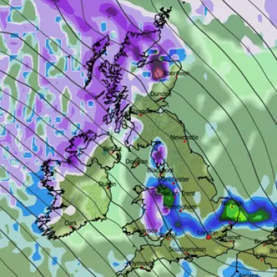
The Met Office has taken the significant step of issuing a rare Amber weather warning for heavy snow across parts of the country. This comes as weather maps turn a deep blue, signalling the arrival of an intense cold front from the Arctic. Jim Dale, chief meteorologist at British Weather Services, told the Mirror that the UK faces a "continuously uncertain" situation until the end of the week, with Thursday 8th and Friday 9th January pinpointed as particularly hazardous.
"If people think the weather has been hazardous during the past week, just wait until next week unfolds, as Atlantic air battles the Arctic air in situ," Mr Dale stated. He warned that a dangerous mix of freezing temperatures, heavy snow, ice, freezing rain, and high winds is in the forecast. The frozen conditions could lead to the official naming of Storm Chandra by the Met Office.
Widespread Disruption and Record Snowfall
The severe conditions have already begun to cause significant disruption across the nation. On Monday, hundreds of schools were forced to close, flights were cancelled, and roads ground to a standstill, particularly in Scotland. The Scottish Highlands recorded a staggering 34cm of snow at Loch Glascarnoch, with substantial accumulations also seen in Dyce, Aberdeenshire (27cm), and Sennybridge in Powys (19cm).
Amber warnings for snow were active until 10am on Monday for areas including Aberdeen, the Cairngorms, and the Highlands, forecasting major travel disruption. Separate yellow warnings for snow and ice covered much of the rest of the UK. The UK Health Security Agency (UKHSA) has concurrently issued an amber cold health alert for England, valid until Friday, warning of the serious impact the adverse temperatures could have on public health.
Forecast for a Treacherous Week
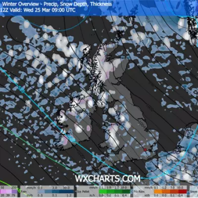
Looking ahead, the situation is expected to worsen. Weather models indicate that almost all of the UK could see some snow before Friday, with the upper reaches of Scotland potentially bracing for up to 3ft (90cm) of accumulation. The main snow risk is currently focused on the Midlands and northern regions, but forecasters caution this could easily shift.
The impending -8C Arctic blast adds a severe frostbite risk to the travel chaos. Overnight lows have already dipped to -10.9C in Shap, Cumbria. Should Storm Chandra be named, it would follow Storm Bram from December and Storm Amy from October 2025, the latter of which resulted in a fatality in Ireland and left tens of thousands without power.
Authorities are urging the public to prepare for a week of extreme conditions, to avoid unnecessary travel in affected areas, and to check on vulnerable neighbours as the fierce winter weather grips the nation.


