
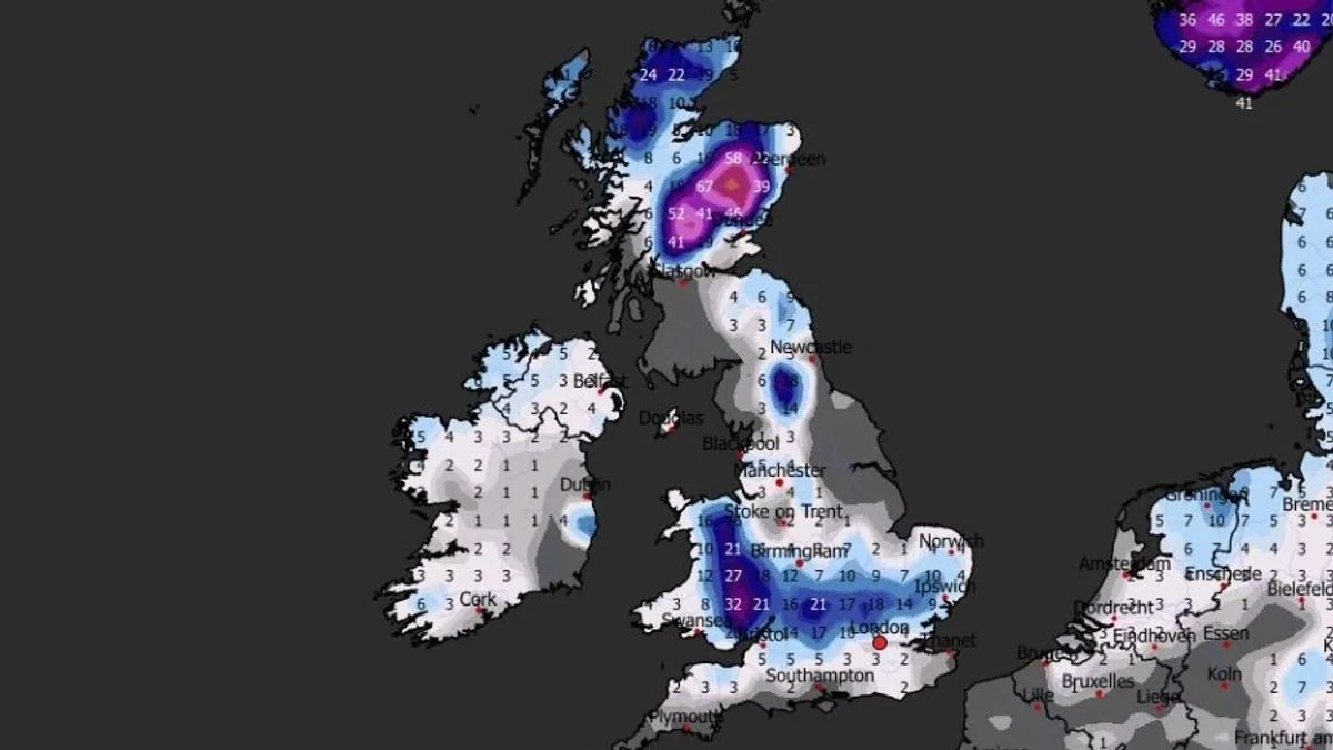
Weather maps indicate a six-day blizzard could bring up to 100cm (40 inches) of snow to parts of the UK, with the entire length of the country potentially covered by February 11. The GFS weather model shows snow starting on February 6 in Wales, the Midlands, north-east England, and Scotland, before spreading south.
By February 7, snow is expected in London, East Anglia, and the north-west, with further flurries in Wales and the Midlands. The Scottish Highlands could see the heaviest accumulations of 100cm, while South Wales may get 32cm, Oxfordshire 21cm, East Anglia 10cm, and areas near London 8cm.
Currently, Storm Chandra is bringing wintry showers, rain, and strong winds, prompting multiple Met Office weather warnings. A major incident was declared on Tuesday night due to flooding risks. As of Wednesday, 95 flood warnings and 257 flood alerts are in force in England, with additional warnings in Wales and Scotland.
Yellow ice warnings cover much of England, Wales, Northern Ireland, and southern and central Scotland for Wednesday morning. A yellow rain warning is in place for South West England on Thursday, with the Met Office warning of further flooding and transport disruption.
The Met Office's long-range forecast for February 10-24 suggests an increased risk of wintry hazards, especially where precipitation from the southwest meets cold air in the north and northeast. BBC Weather also notes the possibility of hill snow and wintry showers, with milder weather expected to reach Scotland last.




