The Met Office has taken the drastic step of issuing a rare red weather warning, its highest alert level, as Storm Goretti bears down on the United Kingdom. Authorities are telling people in the most affected areas to stay indoors for their own safety.
What the Red Warning Means
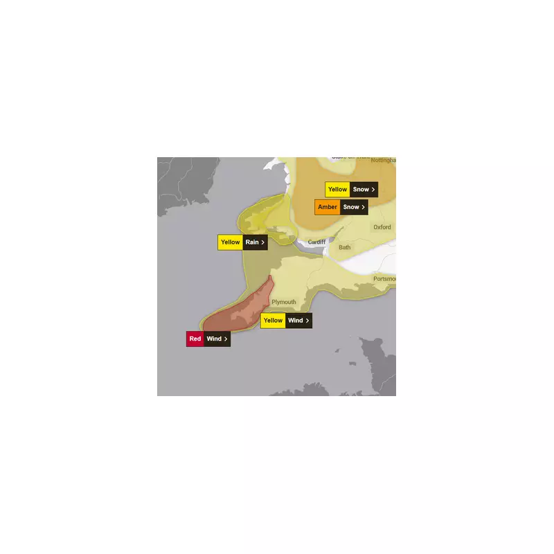
This severe alert has been escalated from an amber warning and covers parts of the South West of England. Specifically, the Isles of Scilly and parts of Cornwall are expected to face the brunt of the storm on Thursday evening, 8 January 2026.
The national weather service warns that Storm Goretti will unleash a period of exceptionally strong northwesterly winds. In exposed coastal locations, gusts could reach a terrifying 80 to 100 miles per hour or even higher.

Timeline of Dangerous Conditions
The situation is forecast to deteriorate rapidly. Winds are predicted to increase suddenly from 30-40 mph to violent, damaging gusts. This dangerous peak is expected to last for two to three hours before conditions begin to ease.
However, the threat will not pass quickly. A broader yellow warning for strong winds will remain in force across the region until Friday morning. The Met Office also highlights a major secondary danger: very large waves will create life-threatening conditions along some coastlines, with a significant risk of damage from sea spray and debris.
Immediate Advice and Broader Impact
The core message from officials is unequivocal. People in the red warning zone should avoid all non-essential travel and remain inside sturdy buildings until the worst of the storm has passed. Disruption to transport, power supplies, and communication networks is highly likely.
This red alert signifies a potential threat to life from flying debris, damage to buildings, and the extreme conditions at sea. It serves as a stark reminder of the power of British winter storms and the critical importance of heeding official safety advice.