Britain faces a renewed threat of severe winter weather, with advanced forecasting models predicting a potential three-day blizzard just days after the chaos of Storm Goretti. New data suggests significant snow accumulations, particularly in northern regions, could begin on January 18.
Maps Reveal Timeline of Wintry Onslaught
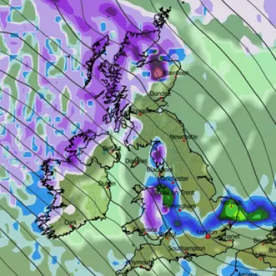
According to detailed weather modelling from ECMWF and WXCharts, the fresh bout of snow will first sweep into parts of northern England and Scotland in the early hours of Sunday, January 18. A major weather front moving in from the Atlantic around 6am is expected to bring the initial flurries alongside heavy rain to lower-lying areas across the country.
The situation is forecast to intensify into Monday, January 19, with further snow predicted for several regions. The south-west of England, Wales, the Pennines, the Yorkshire Dales, and western Scotland are all in line for disruption. Alarmingly, the data indicates snow could fall at a rate of around four inches per hour in parts of Scotland.
Peak Accumulations and Widespread Impact
The wintry conditions are projected to persist into Tuesday, January 20, targeting large swathes of the Midlands and northern England by 6am. Cities including Manchester, Liverpool, and Stoke-on-Trent could all see snowfall, with possible accumulations of up to one inch per hour at the peak.
Snow depth charts for midday on January 20 paint a stark picture, especially for Scotland. They indicate a staggering 40 centimetres (16 inches) could settle on the ground in parts of northern Scotland. Wales could see up to 7cm (3 inches), with around 6cm (2 inches) possible in northern England.
Context of Ongoing Weather Warnings
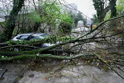
This new forecast follows a period of significant disruption caused by Storm Goretti. The Met Office issued a suite of warnings for snow, ice, wind, and rain, with a rare red wind warning in the south-west. Tragically, the storm led to a fatality after a tree fell on a caravan.
As the UK transitions to milder air, the Met Office has warned of a final disruptive spell. Met Office Chief Forecaster Rebekah Hicks stated that where this milder air meets the lingering cold, notable snow accumulations are expected in Scotland, with a further 20-30cm possible in the Highlands alongside strong winds. She also highlighted risks of freezing rain and flooding from snowmelt.
The BBC's longer-range forecast also hints at unsettled conditions, noting the potential for a "potent low pressure system" late next week, bringing heavy rain, strong winds, and snow over higher ground in northern Scotland.
Authorities are urging the public to stay updated with the latest forecasts and warnings from the Met Office and local responders as the volatile weather pattern continues.


