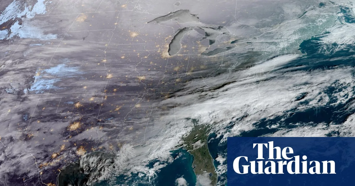
An unprecedented Arctic hurricane is forecast to form off the US East Coast, placing millions of Americans under threat from extreme cold temperatures, heavy snowfall, and perilous winter conditions. Meteorological models indicate this powerful system will develop near the Carolinas early Saturday before undergoing explosive intensification, meeting the criteria for a bomb cyclone.
Meteorological Warnings and Forecast Details
Renowned meteorologist Ryan Hall, widely known as 'The Internet's Weather Man,' has issued stark warnings about this developing system. Hall described the approaching storm as essentially a hurricane, noting that it will develop in the Atlantic with characteristics similar to a tropical cyclone. "Whoever ends up on the western side of that in the cold area is going to get absolutely clobbered with snow," Hall cautioned during his Tuesday forecast.
Temperature Plunge and Geographic Impact
The impending Arctic blast promises to be exceptionally severe, with temperatures predicted to plummet dramatically across multiple regions. Florida is expected to experience near-freezing conditions on Sunday, with even Miami potentially reaching temperatures in the 30s Fahrenheit. Throughout the rest of the country, including portions of the South, Midwest, Northern Plains, and Northeast, temperatures could fall near zero degrees Fahrenheit on Sunday morning, significantly increasing risks of hypothermia and frostbite for anyone spending time outdoors.
Storm Intensity and Pressure Measurements
Current forecasts suggest the storm will form as an exceptionally strong low-pressure system off the North Carolina coast by Sunday. Hall's latest analysis indicates the system appears to be strengthening significantly, potentially dropping to around 965 millibars of atmospheric pressure. This measurement represents an unusually intense system for a winter storm, comparable in strength to a Category 1 hurricane. Normal sea-level pressure typically measures about 1,013 millibars, making this predicted drop particularly concerning for its potential to generate powerful winds, heavy snowfall, and rapidly deteriorating conditions.
Potential Snowfall Patterns and Geographic Spread
The precise trajectory of this developing storm remains uncertain, creating significant variation in potential snowfall predictions. Some meteorological models suggest the system may track farther out to sea, primarily affecting ocean and coastal areas while sparing major metropolitan regions from Washington DC to Boston from substantial snowfall. However, alternative projections indicate the bomb cyclone could form closer to the coastline, potentially delivering six to seven inches of snow to much of the East Coast, including major cities like New York, Philadelphia, and Boston.
Early prediction models show the storm could bring heavy snowfall to multiple states from Saturday through Monday, potentially affecting the Carolinas, Virginia, West Virginia, Maryland, Delaware, New Jersey, Pennsylvania, and New York. Massachusetts, Connecticut, Rhode Island, New Hampshire, and Maine could also find themselves in the storm's path. In southern regions, including parts of North Carolina, South Carolina, and southeast Virginia, several inches of snow are possible, with some locations potentially receiving one to two feet of accumulation.
Expert Analysis and Context
AccuWeather Director of Forecasting Operations Carl Erickson emphasized the increasing risk posed by this rapidly strengthening coastal storm. "Communities along the East Coast still digging out and cleaning up from last weekend's storm could be hit again with more snow," Erickson noted in a recent statement. He further explained that unrelenting cold air has become "locked in" across much of the country due to the polar vortex descending over the United States, complicating recovery efforts as ice remains unable to melt naturally.
Broader Weather Context and Recent Impacts
This developing storm arrives as many regions continue recovering from Winter Storm Fern, which recently dropped more than a foot of snow and several inches of ice along a 2,000-mile stretch of the United States. The aftermath of that storm has left nearly 400,000 Americans in Louisiana, Mississippi, Tennessee, and Kentucky without power as of Tuesday, according to data from PowerOutage.us. Tragically, over 30 people have died following the massive snow and ice storm that swept across more than half the country last weekend.
The treacherous weather began impacting parts of the South and Plains on Friday, bringing ice, freezing rain, and snow before spreading eastward through Sunday night. On Monday, wind chills approaching 30 degrees below zero were recorded in multiple states including Ohio, Nebraska, and Minnesota. Hall has noted that areas in the South, including parts of Tennessee and Mississippi still experiencing power outages, will likely face severe impacts from the intense cold sweeping across the United States later this week.
Polar Vortex Explanation and Health Risks
The extreme weather patterns are being driven by disruptions to the polar vortex, a spinning whirlpool of cold air typically contained high in the atmosphere above the North Pole. Normally held in place by strong winds that act as a barrier, this vortex has been knocked off balance by strong storms and high-pressure systems in the lower atmosphere, allowing icy air from Canada and Greenland to dip farther south and blanket the United States for weeks.
Erickson highlighted the increased health risks associated with these conditions, stating, "The bitter cold is increasing the risk of hypothermia for people who are still without power and heat after the storm." He further explained that while ice typically melts within a day or two after most southern ice storms, "That's simply not happening with this Arctic air locked in."
As the weekend approaches, meteorologists continue monitoring this developing Arctic hurricane and bomb cyclone, warning that temperatures are expected to become even colder than during Winter Storm Fern, creating potentially dangerous conditions for millions along the US East Coast and beyond.