
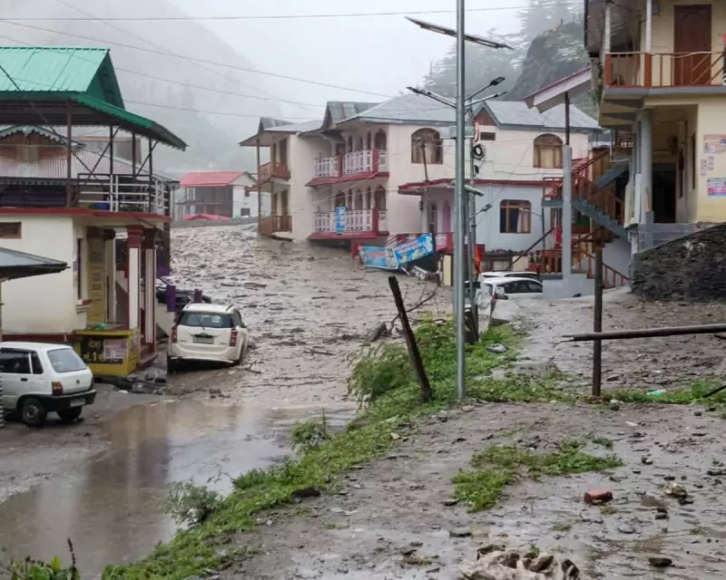
In a tragic turn of events, a sudden cloudburst in northern India has triggered catastrophic flash floods, leaving devastation in its wake. But what exactly is this rare weather phenomenon, and why does it wreak such havoc?
What is a Cloudburst?
A cloudburst is an extreme rainfall event where a massive amount of rain—sometimes exceeding 100mm per hour—falls in a very short period, often over a small area. These deluges are most common in mountainous regions, where moist air rises rapidly, cools, and condenses into intense thunderstorms.
Why Are Cloudbursts So Dangerous?
The sheer volume of water released in minutes can overwhelm drainage systems, trigger landslides, and send torrents of water rushing through valleys. The recent disaster in India highlights just how deadly these events can be:

- Flash flooding with little to no warning
- Destruction of homes and infrastructure
- Loss of life due to rapidly rising waters
Can Cloudbursts Be Predicted?
While meteorologists can forecast heavy rain, pinpointing the exact location and intensity of a cloudburst remains challenging. Advanced radar systems and weather modelling are improving early warnings, but their sudden nature makes them particularly hazardous.
Climate Change Connection
Scientists warn that a warming atmosphere may increase the frequency of extreme rainfall events. As air temperatures rise, the atmosphere can hold more moisture, potentially leading to more intense downpours during monsoon seasons.
The recent tragedy serves as a stark reminder of nature’s raw power and the urgent need for better preparedness in vulnerable regions.


