
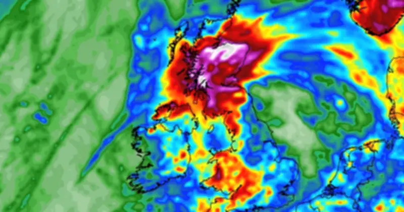
UK weather maps show that heavy rain and a temperature drop to 9C are set to sweep the nation, ending the recent warm spell. According to WX Charts, the change will occur overnight on July 19, with no part of the UK spared from torrential downpours.
Temperature Drop and Affected Areas
Minimum temperatures are expected to drop to 9C across at least 14 Scottish unitary councils, including Aberdeenshire, Aberdeen, Angus, Argyll and Bute, Perth and Kinross, Stirling, southern areas in the Highlands, Mid Lothian, East Lothian, East Ayrshire, South Lanarkshire, Dumfries and Galloway, and the Scottish Borders. Temperatures in England and Wales will be warmer, ranging from around 10C in northern England to the mid-teens along the south coast.
Met Office Long-Range Forecast
The Met Office has also warned of thunderstorms and possibly unsettled weather. Their long-range forecast states: "High pressure is likely to be situated to the north of the UK with low pressure over the Bay of Biscay. This will lead to an easterly flow being dominant to start the period and broadly settled weather for much of the UK. There will, however, be a risk of thunderstorms spreading into the south of the UK from France at times. Temperatures will be warm or very warm for most, perhaps hot at times in the southwest, but probably not as hot as of late. Later in this period the chance of low pressure increases, which may bring spells of wet and windy weather at times."
Outlook for Late July and Early August
A further forecast from the Met Office for July 23 to August 6 confirms a "mixed" period. The forecast reads: "The signal through the end of July and into August becomes increasingly mixed with spells of low pressure and more unsettled weather becoming more likely. There may still be some thunderstorms at times as well. There will still probably be some dry interludes, most probably in the south and southeast. Temperatures are likely to remain warm or very warm and some spells of hot weather remain possible."




