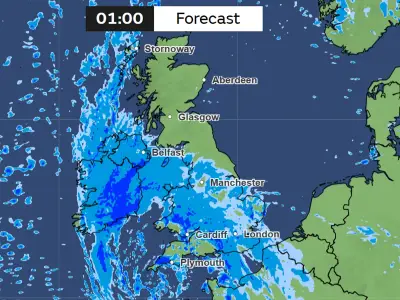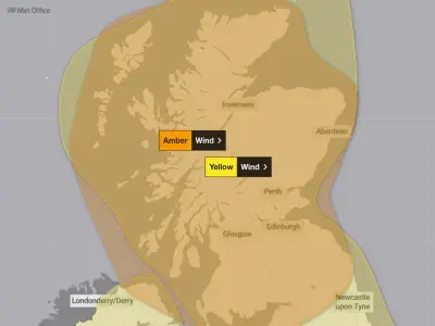
The Met Office has issued a yellow weather warning for strong winds and rain affecting 42 areas across northern England and Scotland, with households urged to prepare for potential power cuts before Tuesday morning as Storm Boelo approaches.
The warning, which covers much of the north of England and Scotland, is in effect from 3am on Tuesday, October 27 until midnight. Gusts of 50-60 mph are possible quite widely, while some coastal or exposed areas could see gusts of 70 mph or more. The Met Office noted that there is some uncertainty in where, and how strong, the peak gusts will be.
Storm Boelo brings travel disruption and damage risk
Storm Boelo is set to bring travel disruption and damage to the affected areas on Tuesday. The Met Office warned: "A period of strong winds may lead to damaging gusts and transport disruption."
Households in the affected areas are being encouraged to stock up on essential items to cope with potential power cuts. The Met Office advises: "People cope better with power cuts when they have prepared for them in advance. It's easy to do; consider gathering torches and batteries, a mobile phone power pack and other essential items."
Advice for residents and drivers
The Met Office also recommends that residents check if their property could be at risk of flooding, and if so, consider preparing a flood plan and an emergency flood kit. It adds: "Be prepared for weather warnings to change quickly: when a weather warning is issued, the Met Office recommends staying up to date with the weather forecast in your area."
For those who must drive during the storm, the Met Office advises driving slowly to minimise the impact of wind gusts, being aware of high-sided vehicles and caravans on more exposed roads, being cautious when overtaking, and giving cyclists, motorcyclists, lorries, and buses more room than usual.
Coastal residents are warned to be aware of large waves, as even from the shore large breaking waves can sweep people off their feet and out to sea. The Met Office advises taking care when walking near cliffs, knowing your route, and keeping dogs on a lead. In an emergency, it says to call 999 and ask for the Coastguard.
Full list of 42 affected areas
The full list of 42 UK areas covered by the warning is as follows:
- Dumfries and Galloway
- East Lothian
- Edinburgh
- Midlothian Council
- Scottish Borders
- West Lothian
- Argyll and Bute
- East Ayrshire
- East Dunbartonshire
- East Renfrewshire
- Glasgow
- Inverclyde
- North Ayrshire
- North Lanarkshire
- Renfrewshire
- South Ayrshire
- South Lanarkshire
- West Dunbartonshire
- Orkney Islands
- County Antrim
- County Down
- County Londonderry
- Cumbria
- Durham
- Gateshead
- Newcastle upon Tyne
- North Tyneside
- Northumberland
- South Tyneside
- Sunderland
- Na h-Eileanan Siar
- Highland
- Aberdeen
- Aberdeenshire
- Moray
- Angus
- Clackmannanshire
- Dundee
- Falkirk
- Fife
- Perth and Kinross
- Stirling
If residents experience a power cut, they are advised to call 105 from their mobile to report it. The strongest winds are expected to reduce from the southwest later on Tuesday, with the far north of Scotland the last to see winds ease.