The Met Office has warned that Storm Austen is set to bring disruptive winds and rain to the UK later this week, with a yellow weather warning affecting parts of the country on Friday, October 23.
A 12-hour yellow weather warning for wind will come into effect at 12am on Friday, affecting parts of London, south west England, Wales and the West Midlands.
Warning Details and Expected Gusts
The Met Office warning reads: "A period of strong winds may lead to damaging gusts and transport disruption," and further description says: "Strong west to northwesterly winds may spread across southern parts of England and Wales on Friday."
It continues: "Gusts of 50-60 mph are possible and some coastal or exposed areas could see 70 mph or more, but at this time there is uncertainty in where the strongest winds will be. There will be some periods of heavy rain which will make travel more difficult. Whilst it will remain breezy the winds will probably ease late morning into the early afternoon."
Storm Austen Named by Met Office
The UK weather agency has named Storm Austen as the area of low pressure set to bring disruptive wind and rain to some parts of the country from late Thursday and into Friday.
Met Office Deputy Chief Forecaster Tom Crabtree said: "While the exact track and position of Storm Austen is still being determined, what’s clear is that we have an impactful period of weather on the way and the potential for disruption in places, which has resulted in the system being named.
"Peak gusts in excess of 70mph are possible on the most exposed coastal areas, while 50-60mph are likely more widely within the warning area. Weather warnings are under constant review and could be updated as confidence increases, so it’s important to stay up-to-date with the forecast in the coming days."
Rain Forecast and Weekend Outlook
Storm Austen will move from west to east through Friday, the Met Office says, with winds generally diminishing later in the day. Rain is an additional hazard, with 20-30mm in many places and higher totals possible over higher ground in the west and further north on Friday.
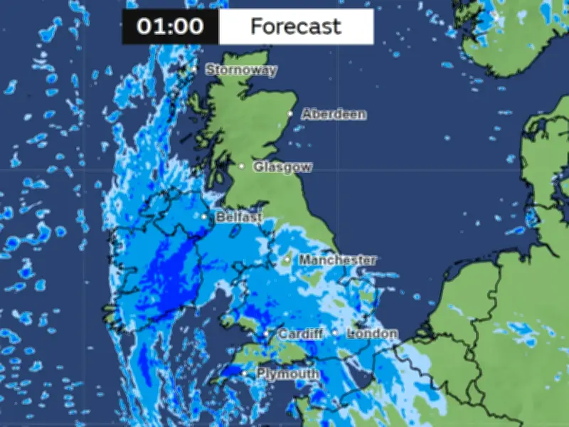
Met Office weather maps show the area of rain and weather to the southwest of the UK, approaching Ireland and south west England on Thursday evening at 4pm. By 1am on Friday, the area of weather has moved upwards over the UK, covering Greater Manchester and other parts of the country with rain. On Saturday, another huge wall of rain is set to sweep across the UK, covering the whole country from the Scottish highlands all the way down to the bottom of England.