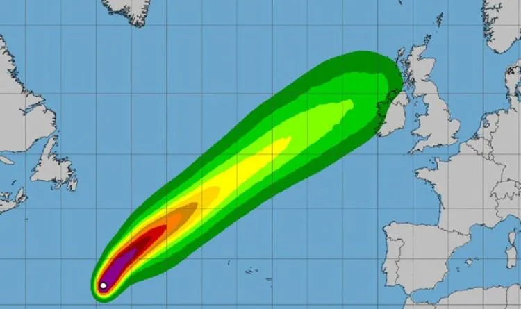
The meteorological world is watching with bated breath as Hurricane Gabrielle continues its powerful journey across the Atlantic. While still far from British shores, sophisticated forecasting models—colloquially known as 'spaghetti models'—are beginning to sketch out potential scenarios for how this tropical system might influence UK weather patterns in the coming days.
Decoding the Spaghetti Models: A Tangled Forecast
The term 'spaghetti models' refers to the complex computer-generated projections that meteorologists use to predict a storm's path. When viewed together, the multiple lines resemble a plate of spaghetti. For Hurricane Gabrielle, these models show a remarkable consensus, indicating a high probability of the storm's remnants being swept towards Western Europe by the jet stream.
While Gabrielle is expected to weaken significantly before approaching the UK, converting from a hurricane to a potent extra-tropical low-pressure system, it could still deliver a substantial punch. The Met Office is closely monitoring the situation and may issue formal weather warnings as the forecast becomes more certain.
Potential Impacts on the UK
Current projections suggest the system could bring:
- Heavy rainfall: Potential for localized flooding, particularly in western regions
- Strong winds: Gusts potentially exceeding 50-60 mph in exposed coastal areas
- Coastal concerns: Large waves and storm surge possibilities along southwestern coasts
- Travel disruption: Potential impacts on air, rail, and ferry services
The exact intensity and timing of these effects will depend on the storm's precise track, which forecasters will refine over the next 24-48 hours.
Expert Analysis: Why This Storm Bears Watching
Meteorologists emphasize that while post-tropical systems like Gabrielle typically lose their hurricane characteristics, they can still transport enormous amounts of energy and moisture. "What makes these systems particularly challenging to forecast," explains a senior Met Office forecaster, "is their transformation process. They can sometimes intensify rapidly as they interact with mid-latitude weather systems, a phenomenon known as explosive cyclogenesis."
Residents across the UK, particularly in Ireland, Wales, and Southwestern England, are advised to stay updated with the latest forecasts from the Met Office. The coming days will be critical for determining the exact impacts Gabrielle might bring to British shores.