
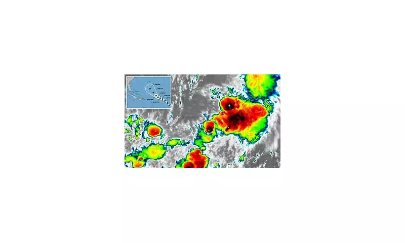
The formidable Hurricane Gabrielle, after unleashing its power along the US coastline, has been downgraded to a tropical depression. However, this is not the end of the story for this relentless weather system.
According to the latest advisory from the National Hurricane Center (NHC), the storm is expected to move back over the warm waters of the Atlantic Ocean. This shift in environment provides the essential fuel for the depression to reorganise and potentially intensify once more, posing a significant question for forecasters on this side of the pond.
A Transatlantic Journey Under Watch
Meteorologists at the UK Met Office are now closely monitoring Gabrielle's projected path. While it is too early to predict with absolute certainty, historical data and current modelling suggest the system could influence British weather in the coming days. The key question is whether it will curve harmlessly northwards or bring bouts of severe wind and rain to the British Isles.

The storm's behaviour is a classic example of how tropical systems can evolve and impact regions thousands of miles from their origin. The warm ocean currents play a critical role in either sustaining a storm's fury or causing it to dissipate.
What This Means for the UK
For now, the message from weather experts is one of vigilant observation. Residents are advised to stay updated with the latest forecasts from the Met Office as the situation develops. The potential remains for the ex-hurricane to bring unsettled conditions, particularly to western coastal areas.
This event underscores the interconnected nature of global weather patterns and the importance of sophisticated tracking technology in providing early warnings to keep the public safe.


