
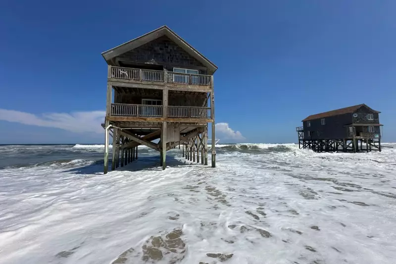
The fragile barrier islands of North Carolina's Outer Banks are bearing the brunt of Hurricane Erin's fury, as the powerful storm triggers severe coastal erosion and flooding along the famed shoreline.
Despite remaining offshore, Erin's expansive wind field is wreaking havoc, churning up the Atlantic and devouring precious beachfront. The US National Hurricane Center reported the storm's centre was located approximately 260 miles south-southwest of Cape Hatteras, moving north-northeast at 9 mph.
Coastal Communities on Alert
Residents and officials are witnessing significant damage as the hurricane-force winds extend 45 miles from its core, with tropical-storm-force winds reaching up to 160 miles. This immense reach is causing substantial beach erosion along the entire Outer Banks coastline.

The National Weather Service has issued dire warnings for dangerous rip currents and life-threatening surf conditions, urging extreme caution for beachgoers and mariners.
A Familiar Threat Intensifies
For the communities of the Outer Banks, this scenario is becoming frighteningly familiar. The combination of rising sea levels and increasingly powerful storms is creating a perfect storm for accelerated coastal erosion, threatening homes, infrastructure, and the very existence of these iconic islands.
Emergency services remain on high alert as meteorologists monitor Erin's path closely. The storm's parallel movement along the coast, while keeping the worst winds offshore, continues to generate destructive waves and storm surge that eat away at the vulnerable shoreline.
Local authorities are assessing the damage and preparing for potential further impacts as hurricane season continues to intensify.


