
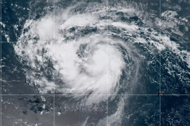
Hurricane Erin has escalated into a formidable Category Five hurricane as it churns through the Atlantic, raising alarms among meteorologists and emergency response teams. The storm's rapid intensification has triggered urgent warnings for coastal communities, with experts closely monitoring its trajectory.
Unprecedented Strength
With sustained winds exceeding 157 mph (252 km/h), Hurricane Erin now ranks among the most powerful storms of the season. The National Hurricane Centre (NHC) has classified it as "extremely dangerous," urging residents in vulnerable areas to take immediate precautions.
Potential Impact Zones
While the exact path remains uncertain, forecast models suggest possible threats to islands in the eastern Caribbean. Authorities are preparing evacuation plans and stockpiling emergency supplies ahead of potential landfall.

Climate Change Connection?
Scientists note that Erin's rapid intensification aligns with patterns observed in warming ocean temperatures. "While no single storm can be attributed to climate change, we're seeing more of these rapid intensification events," explained Dr. Lisa Monroe, a leading climatologist.
Preparations Underway
Emergency management teams across the region are activating disaster protocols, including:
- Pre-positioning relief supplies
- Securing critical infrastructure
- Establishing emergency shelters
Shipping lanes have been advised to reroute, while airlines are monitoring the situation for potential flight disruptions.
The NHC will provide updates every three hours as the situation develops. Residents are advised to follow official guidance and avoid coastal areas until the storm passes.


