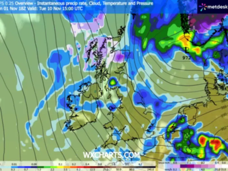
Weather maps from the GFS model suggest snow could fall across parts of the UK next week, with flurries potentially reaching Northumberland and other areas of the North East as temperatures turn colder. The Met Office has forecast a change in conditions towards the end of this week, while the GFS model indicates snow could develop in parts of the country on Tuesday, November 10, before possibly spreading further south.
Snow Projections for November 10-11
According to the model, snow could initially fall across northern parts of Scotland on Tuesday afternoon before moving south. By 3am on Wednesday, November 11, the GFS maps suggest snow could affect North Wales and parts of north-west England, with some areas potentially seeing snowfall rates of around 4mm per hour before the wintry conditions move south-eastwards.
By 6am, the heaviest snowfall is projected to be concentrated across eastern parts of England, with some flurries potentially reaching areas close to the south coast. Maps for 9am suggest snow could settle across parts of northern, central and south-eastern England. However, accumulations are not expected to exceed around 1cm in most areas, with greater amounts possible on higher ground in Scotland.
North East Areas Highlighted
The GFS model suggests around 50 counties across England, Scotland and Wales could see some snow during the period. Northumberland and County Durham are among the areas highlighted in the projections. Other areas in the wider forecast include Cumbria, Lancashire and parts of Yorkshire, alongside locations across Scotland and Wales.
However, the maps are long-range forecasts and do not confirm that snow will fall in the North East. The timing, location and extent of any snowfall could change as next week approaches. Any snowfall in the region would depend on temperatures and weather conditions at the time, so the projections should be treated as a possible scenario rather than a confirmed forecast.
Met Office Outlook
The Met Office expects largely settled conditions across the North East in the coming days, although cloud and occasional showers are possible. Its regional forecast for Monday, November 2, said there would be long bright spells initially, with cloud increasing through the morning and mainly light showers potentially developing during the afternoon. Conditions are expected to be similar on Tuesday, November 3, with bright spells at first before cloud increases, though showers are forecast to be less frequent and many areas should stay dry.
The outlook for Wednesday to Friday suggests high pressure will continue to dominate, bringing generally cloudy conditions and occasional showers, with temperatures expected to remain around normal for the time of year. The Met Office's wider UK forecast says conditions are expected to turn colder by Friday, with cold starts and occasional mist and fog possible in northern areas.
The Met Office's long-range outlook for November 6 to 15 says high pressure is likely to dominate across much of the UK initially, with temperatures starting a little below average before returning to near or slightly above average. Forecasters say the exact development of weather systems later in the period remains uncertain. While the GFS model has indicated the possibility of snow across parts of the UK on November 10 and 11, the Met Office's longer-range forecast does not currently confirm a widespread snowfall event, and the outlook could change in the coming days as forecasters gain a clearer picture of the weather expected next week.