
Britain is bracing for a potentially snowy finale to 2025, with fresh meteorological data indicating a significant blizzard could deposit up to six inches of snow in some regions before New Year's Eve.
Snow Timeline and Initial Impact
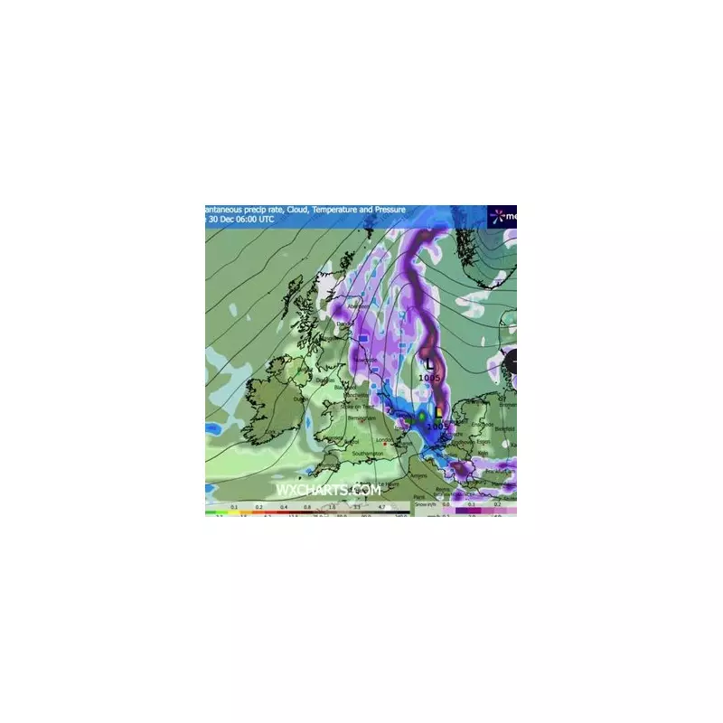
According to the GFS weather model, a substantial and persistent band of snow is projected to push westwards across the British Isles. The first flurries could begin as early as 6am on Tuesday, December 30. The initial brunt of the wintry weather is expected to hit Scotland and the far north of England first.
Aberdeen and Newcastle are pinpointed as among the earliest cities to be affected. While Newcastle may see lighter initial accumulations, conditions in northeast Scotland could be more severe from the outset. Snow depth charts suggest Aberdeen could witness up to three inches of snow by the morning.

Widespread Accumulation and Southern Reach
By midday on the 30th, snow depths are forecast to increase sharply, particularly across Aberdeenshire and areas north of Dundee, where totals could climb to five inches or more. The maps indicate the worst-hit spots may receive the full six inches.
The snowfall is not confined to the north. Manchester, Stoke-on-Trent, and Birmingham are also in line to see snow settle. Throughout the afternoon and evening, the wintry conditions are predicted to spread further south, potentially affecting Middlesbrough, York, and Leeds, with the North York Moors at risk of persistent flurries.
By the evening, parts of Newcastle, Middlesbrough, and York could see around three inches of accumulation. The data also suggests lighter snowfall could reach East Anglia, Kent, Essex, and even parts of London and Wales.
Lingering Conditions and Official Outlook
The snow is expected to continue into Wednesday, December 31, with the heaviest and most persistent band lingering across northern areas, including Newcastle. This wintry forecast follows a recent Met Office update for the Christmas period.
Deputy Chief Forecaster Tom Crabtree stated: "High pressure is expected to build into next week, bringing drier and less mild conditions for the Christmas period. Although temperatures will drop, they are not plummeting." He added that while overnight frosts, mist, and fog are likely, significant cold weather looks less probable, but noted "the potential for some wintry showers in the east."
Residents across the UK, especially in the highlighted regions, are advised to monitor the latest weather warnings and travel updates as the potential for disruptive snow draws closer.


