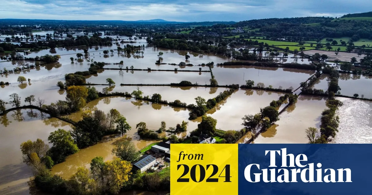
Forecasters have declared there is "no end in sight" to the relentless wet weather plaguing the United Kingdom, as parts of south-west England and South Wales have recorded rainfall on every single day of 2026 so far. The Met Office has confirmed that this daily deluge is expected to continue through Sunday, exacerbating conditions in regions that already endured a January with 50 per cent more rainfall than the seasonal average.
Widespread Weather Warnings and Flooding Risks
A yellow rain warning remains in effect from 5am on Thursday to 9pm Friday, covering extensive areas of Wales, south-west England, south-east England, and the West Midlands. The Met Office has cautioned that due to the already saturated ground, surface water flooding is highly probable, with a risk of some homes and businesses being inundated.
Simultaneously, Northern Ireland is under a separate yellow warning from midday Thursday to midnight Friday, while a snow alert is active from 3pm Thursday to 3am Friday across parts of the East Midlands, north-east England, north-west England, and Yorkshire. These multiple advisories highlight the severe and varied nature of the ongoing weather disruptions.
Aberdeen's Record-Breaking Gloom
In a stark contrast to the southern downpours, Aberdeen has been shrouded in continuous cloud cover, with no sunshine observed for two full weeks. This marks the longest such period of unbroken gloom for the city since meteorological records began in 1957, and forecasts indicate this dreary pattern is set to persist.
Met Office operational meteorologist Dan Stroud provided a grim outlook, stating, "Unfortunately, there's no end in sight." He explained that the rainfall in January across the south-west region ranked as the 12th highest on record, underscoring the exceptional nature of this wet spell.
Detailed Forecast and Atmospheric Causes
Another band of rain is predicted to sweep northwards from the south-west on Friday, bringing with it heavy bursts of precipitation. Heavy showers will continue to affect southern areas on Saturday morning before gradually pushing upwards into Wales and the Midlands.
Eastern Scotland, including Aberdeen, will remain under a persistent blanket of cloud and rain. However, some brightness may break through on Saturday for parts of East Anglia, the south-east, and possibly western Scotland. Sunday is expected to offer a slightly drier respite for those not in the southern and western parts of the UK, though yet another band of rain is forecast to arrive in those regions.
Mr Stroud elaborated on the meteorological factors driving this prolonged unsettled weather: "Very little in the way of change, and the reason for it really is that we've got a big area of high pressure way out to the far north and east of the country and that's stopping areas of low pressure from moving through. Until that area of high pressure sort of shifts out of the way, we're not really going to see much of a change in the forecast. At the same time, we've got the jet stream way to the south, bringing exceptional wet weather to Spain and Portugal."
Impacts and Precautions
The yellow warning for parts of England and Wales anticipates rainfall totals of 20-30mm, with some higher ground areas potentially receiving more than 50mm. The Met Office has warned that journey times and transport services are likely to be significantly affected, and there is a possibility of brief interruptions to power supplies.
Residents in affected areas are advised to stay updated with the latest forecasts and warnings, prepare for potential travel disruptions, and take necessary precautions to protect property from flooding risks. The combination of saturated ground and continued rainfall presents an ongoing challenge for emergency services and infrastructure across the UK.