
For countless Britons sheltering beneath umbrellas, the persistent wet weather across the nation appears unending. Numerous regions have endured rainfall on every single day of the year so far, a total of 38 consecutive days. The Met Office has now confirmed that these dreary conditions are set to persist throughout the coming week, extending the period of damp discomfort.
Active Weather Warnings and Flood Alerts
A significant 12-hour yellow weather warning for rain has been officially issued for South West England and South Wales. This alert is active from midday until midnight, with forecasts predicting up to 30 millimetres, or 1.2 inches, of precipitation. Meteorologists are advising motorists to exercise extreme caution due to potential spray and flooding on roadways. The warning also highlights possible power cuts, train service delays, and the risk of homes being flooded.
Widespread Impact Across the Country
Bands of rain and intense showers are expected to move eastward across southern England and Wales this afternoon. Some areas will also experience strong, gusty winds, compounding the hazardous conditions. More rainfall is anticipated later in the week, though drier and colder weather may arrive by the weekend, coinciding with the February half-term school holidays.

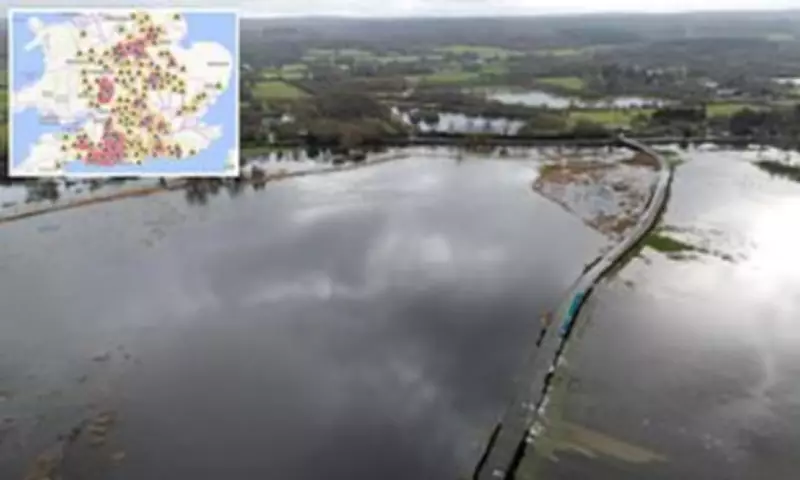
Currently, more than 300 areas remain under flood alert due to the relentless downpours. The Environment Agency has issued 108 immediate flood warnings and 215 flood alerts specifically for England today. The regions most at risk are located in southern and central England. Additionally, Wales has seven active alerts, while Scotland is under six warnings and two alerts.
Meteorological Analysis and Forecast
Temperatures are projected to reach double figures in parts of the Midlands, eastern England, and the South East today. According to Met Office meteorologist Tom Morgan, this might feel relatively pleasant for February. However, he added a note of caution regarding western regions.
"Out towards the west here we have another area of rain pushing in through the afternoon, with the wind strengthening, particularly in the South West," Morgan stated. "The winds are coming in from a south-easterly direction, so it is coming on to coasts that have been particularly affected by recent storms."
He emphasized that the heavy rain is falling on already saturated ground, making further flooding a distinct possibility, especially as evening approaches. Morgan also warned that "potentially some surface water on the roads for Monday evening's rush hour and some difficult driving conditions" could affect parts of Wales, central southern England, and the South East.
Record Rainfall and Unusual Weather Patterns
Last Thursday, the Met Office confirmed that rain had fallen every single day of 2026 in both South West England and South Wales. Both regions experienced a January with 50 percent more rainfall than the seasonal average. Remarkably, the rainfall in the South West last month was the 12th highest on record.
In a separate unusual weather event, forecasters revealed last week that Aberdeen had seen no sunshine for a continuous two-week period. This represents the longest such stretch for the area since records began in 1957, highlighting the broader pattern of atypical and persistent poor weather conditions affecting the United Kingdom.


