
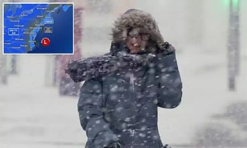
A formidable winter storm is developing off the US East Coast, with meteorological experts issuing stark warnings of potential blizzard conditions, destructive winds and perilously cold temperatures affecting millions of residents this weekend.
Rapid Intensification Along The Coast
As of Friday morning, forecasters anticipate the storm, classified as a bomb cyclone, will form near the Southeast coast close to Georgia and South Carolina early on Saturday. The system is then predicted to undergo rapid intensification as it tracks northward along the coastline throughout Sunday.
Blizzard warnings have been issued across several states, including the Carolinas, Virginia and Massachusetts. Heavy snowfall and whiteout conditions are considered highly probable during the peak of this severe weather event.

Projected Snowfall Totals And Wind Threats
Accumulations are expected to vary significantly along the storm's path. Forecasts indicate Washington, DC may see 1 to 3 inches, Philadelphia could receive 2 to 4 inches, while New York City may experience more than 4 inches. The most severe accumulations, potentially exceeding a foot, are anticipated in eastern North Carolina and coastal Virginia.
Coastal regions stretching from Georgia to Maine face the prospect of wind gusts reaching up to 50mph. Particularly concerning are predictions for parts of North Carolina's Outer Banks, where hurricane-force winds exceeding 80mph are possible.
Understanding The Bomb Cyclone Phenomenon
To comprehend the storm's exceptional intensity, examining atmospheric pressure proves insightful. Pressure is measured in millibars, with lower values indicating a more powerful storm system; standard sea-level pressure typically registers around 1,013 millibars.
A bomb cyclone designation requires pressure to drop by a minimum of 24 millibars within a 24-hour period. A storm descending below 970 millibars signifies an exceptionally intense system. Current forecast models suggest this developing storm could deepen into that critical range as it intensifies offshore.
Expert Analysis From Meteorologist Ryan Hall
Meteorologist Ryan Hall, widely recognised as 'The Internet's Weather Man,' provided a sobering assessment. "This 968 millibar low-pressure centre is analogous to a Category 2 hurricane," Hall stated. "It would be remembered as one of the greatest storms of all time if its trajectory were just slightly further west."
Hall specifically highlighted the extreme wind gusts forecast to accompany the weekend snowstorm, which could reach a devastating 100mph just off the Atlantic coast. In a YouTube video briefing, he urged caution: "Don't be out on the roads. Be prepared. It's literally going to be a blizzard."
The storm is expected to intensify rapidly throughout the day, mirroring the transformation of a tropical storm into a hurricane. It will progress quickly towards the Northeast, passing southeast of Cape Cod by Sunday morning and delivering some of the weekend's most significant snow totals to Massachusetts.
Potential For Historic Winter Storm Impact
Some meteorological models indicate the blizzard could form closer to land, potentially generating a historic, hurricane-like winter storm capable of depositing up to two feet of snow across the Carolinas and Virginia.
While the East Coast prepares for heavy snow and powerful winds, Hall warned that potentially lethal cold temperatures will descend over an even broader expanse of the United States. This Arctic blast could bring historically low temperatures to parts of Florida.
Unusual Southern Snowfall Predictions
The latest forecasts indicate temperatures will plummet so dramatically this weekend that multiple cities along the Gulf Coast might experience flurries or even accumulating snow by Monday.
"You know how we have lake effect snow in the north?" Hall predicted. "Well, it's so cold after the storm passes that we're actually going to have Gulf effect snow in Florida. This is real. We might actually see snow in Tampa."
He further elaborated on the unusual prospect: "We're going to see snow flurries potentially around Orlando, Jacksonville, Daytona Beach. Some models even show the possibility of very light snowflakes in the Bahamas, which would be the first occurrence since the 1970s."

Bitter Arctic Air Mass Follows Storm
During and immediately after the storm this weekend, bitterly cold Arctic air will sweep across much of the central and eastern United States. Temperatures could plunge up to 30 degrees Fahrenheit below normal averages for late January.
In Florida, lows may drop into the 20s or even teens in the northern regions, with wind chills creating sensations in the single digits or below zero. By Sunday morning, temperatures could fall below freezing in Miami.
Regions Facing The Most Severe Cold
The coldest conditions will likely affect northern areas within the storm's path, including the Midwest, Ohio Valley, Great Lakes, Upstate New York and New England. Here, temperatures may fall below zero, particularly across the Northeast.
States confronting the most extreme cold span from Florida, Georgia, the Carolinas and Virginia in the South, to Pennsylvania, New York, Vermont, New Hampshire and Maine in the North.
Compounding Dangers From Lingering Outages
These dangerously low temperatures present extreme hazards, especially in areas still recovering from Winter Storm Fern where lingering power outages persist. Homes without electricity could become life-threatening environments, facing heightened risks of hypothermia, frostbite, frozen pipes and carbon monoxide poisoning from improper heating methods.
As of Thursday, over 200,000 Americans in Louisiana, Mississippi and Tennessee remained without power following Winter Storm Fern, according to data from PowerOutage.us. Estimates continue to rise, but over 100 people are believed to have died following the massive snow and ice storms that swept across more than half the country last weekend.
Prolonged Cold Spell Forecast
Hall added that the extreme cold is likely to persist around the East Coast for at least the coming week. "There's no end in sight with the cold air," he cautioned. "Conditions might moderate slightly closer to the Mississippi River Valley, but below-average temperatures are likely to continue for the East Coast for the foreseeable future. This pattern will eventually shift, but we're not seeing that change anytime soon."


