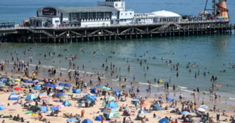
Extremely high temperatures are set to blast at least nine counties in a matter of days, with a 35C scorcher predicted by weather maps. Predictions suggest a swelterer on the way for millions by 6pm on Tuesday June 23, with London and the South East turned into sweat central.
Forecasts propose a heatwave is set to engulf Great Britain in the week ahead, with Essex, West and East Sussex, Berkshire, Middlesex, Kent, Buckinghamshire, Surrey and Hertfordshire all expecting to hit 35C on Tuesday. For much of the rest of England, there will be little respite from the hot and sticky conditions, as cities like Birmingham, Bristol, Oxford, Leeds, Nottingham and Manchester are all likely to hit at least 30C.
Amber Extreme Heat Warning in Place
A Met Office amber extreme heat warning is in place on Monday and Tuesday for London, the east and south-east of England, and parts of the south-west of England and Wales. It flags potential health impacts for people vulnerable to extreme heat and heat-related issues for the wider population, as well as a potential increase in water safety incidents.

The warning, which differs from amber heat health alerts issued by the UK Health Security Agency (UKHSA), comes as another heatwave is expected to sweep parts of the UK during the weekend and early next week. Areas in southern and eastern England are likely to meet the heatwave threshold during the weekend, and there is a 40% chance of exceeding the highest-ever temperature for June, which is 35.6C set in 1957 and 1976, the Met Office said.
Met Office Forecaster Warns of 'Tropical Nights'
Greg Wolverson, deputy chief forecaster at the Met Office, said: “While heatwave criteria will be met for some in the south and south-east of England over the weekend, with temperatures into the low 30s possible, the warmth will expand and intensify at the start of next week, which, coupled with high temperatures overnight, leads to potential impacts.”
“Temperatures will peak around the mid-30s on Monday and Tuesday. The humidity will also mean this feels close, warmer and more uncomfortable for many. Tropical nights – where the temperature doesn’t drop below 20C – are also likely for some,” Wolverson added.
The warmth may bring some thundery downpours for some on Monday and Tuesday, though these should be “fairly isolated”, the Met Office said. The very high temperatures could continue across a smaller part of the country into the middle of the week, but this remains uncertain for now, the forecaster added.
Water Safety Warning After 15 Deaths in May
At least 15 people died after getting into trouble in open water during a hot spell in May. Samantha Hughes, national water safety partner at the Royal National Lifeboat Institution, said: “With warmer weather approaching, it’s important to remember that the water is still cold. Entering it unexpectedly can lead to cold water shock, causing a sudden increase in breathing and heart rate, which may trigger panic.”
After the heat health alerts were issued, the Health and Safety Executive (HSE) said employers must ensure their workers are protected while maintaining productivity during the heatwave.
Met Office Five-Day Forecast
This Evening and Tonight: Showers fading leaving a generally dry night. Light winds and clear skies will allow a little shallow mist and fog to form in prone areas. Feeling fresher for some, but a warm and humid night to come in the south.
Sunday: A fine and dry day ahead with lots of sunshine though a small risk of the odd light shower. Feeling warm, though a hot, humid day ahead in the south.
Outlook for Monday to Wednesday: An extreme heat warning is in place next week for much of England and Wales. The heat will become widespread; turning humid, and this brings the risk of thunderstorms.