
For Andrés Sánchez Barea, in Spain, it was the fear that arose when water started to spurt from plug sockets. For Nelson Duarte, in Portugal, it was the helplessness that hit as violent winds smacked down trees and tore tiles from roofs. For Amal Essuide, in Morocco, it was the reality that dawned when a corpse was pulled onboard a boat in the flooded medina.
Each moment of horror is a fragment of the destruction wrought by an atmospheric machine-gun that in recent weeks has fired storm after storm at the western Mediterranean. Scientists do not know if climate breakdown helped pull the trigger, but research suggests it loaded the chamber with bigger bullets.
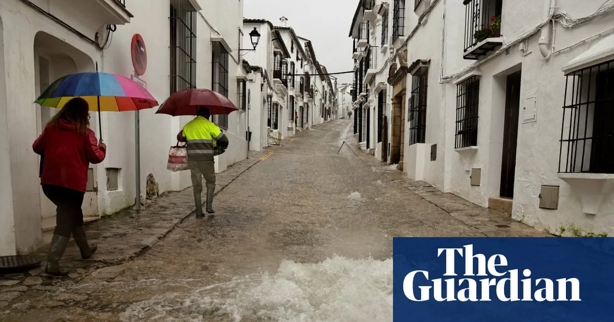
In Grazalema, Spain’s wettest town, a year’s-worth of rain fell in a fortnight and overloaded the karst aquifer beneath it. Water rushed into homes through floors, walls and even electricity sockets. Authorities ordered everyone to evacuate. “I felt a lot of fear,” said Sánchez Barea, a guesthouse owner whose home is one of hundreds still in an exclusion zone.

In Leiria, one of four regions in Portugal where extreme rain broke records in January, powerful winds added to the damage. Monte Real airbase logged a top wind speed of 109mph (176km/h) before the station was hit and measurements stopped. Storm Kristin took out electricity, internet, and telephone service in the early hours of a morning that would soon turn deadly. “It was around this time that everything seemed to be falling apart,” said Duarte, a beekeeper in Monte Real who lost half his hives.
Duarte’s house held, but others’ did not. Ricardo Teodósio, an industrial painter in neighbouring Carvide, was fixing a garage roof with his father when it collapsed on them. Injured, the older man walked two miles to a fire station to get help for his son, who was trapped under the rubble. He was dead by the time they arrived. João Lavos, the commander of the volunteer firefighters of Vieira de Leiria, said Teodósio was one of two people to die in the Carvide-Leiria region that day.
Western Europe has been battered by 16 rapid-fire storms this season due to a shift in atmospheric currents that some scientists suggest will become more common as the planet heats up. While the role that the climate crisis played in the formation of the storms is still uncertain, early analysis from Climate Central found it made a marine heatwave that supercharged the storms in early February 10 times more likely. On Thursday, a study by World Weather Attribution (WWA) found carbon pollution made the rains stronger and the floods worse.


