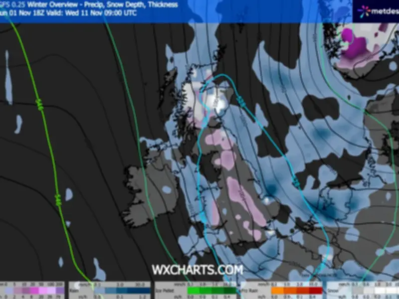
Snow could fall across parts of the UK next week, with weather maps suggesting flurries could reach the North West as temperatures turn colder.
The Met Office has forecast a drop in temperatures towards the end of this week, while the GFS weather model indicates wintry conditions could develop on November 10 and 11.
Where snow could fall
According to the model, snow could initially arrive in northern parts of Scotland on the afternoon of Tuesday, November 10, before spreading further south.
By 3am on Wednesday, November 11, the latest maps suggest snow could affect North Wales and parts of the North West of England. Some areas could see snowfall rates of around 4mm per hour before the wintry conditions move south-eastwards across England.
By 6am, the heaviest snow is forecast to be concentrated across eastern parts of England, with some flurries potentially reaching areas near the south coast.
Accumulations and affected areas
Further maps for 9am suggest parts of northern, central and south-eastern England could see snow settle on the ground. However, accumulations are not expected to exceed around 1cm in most areas, apart from higher ground in Scotland.
The GFS model indicates that around 50 counties across England, Scotland and Wales could see some snow during the period. However, these are long-range model projections and the forecast could change as the date approaches.
Met Office and BBC outlook
The Met Office forecast for the coming days suggests largely settled conditions before temperatures turn colder. For Tuesday, November 3, forecasters expect variable cloud and scattered light showers, with the most frequent showers in the south-east. Temperatures are expected to remain near normal.
Similar conditions are forecast from Wednesday through to Friday, with variable cloud and occasional light showers. Most places are expected to remain dry, although northern areas could experience mist and fog during colder starts. The Met Office says conditions are expected to turn colder by Friday.
The BBC also expects largely dry weather during the coming days, with sunny spells and patchy cloud in many areas. Its forecast says a few scattered showers could affect eastern parts of the UK, while thicker cloud may linger over southern and eastern Scotland.
High pressure is expected to remain in control towards the end of the week. Northern areas could see light winds, sunny intervals and patches of low cloud, with fog possible in some places during the mornings. Further south, conditions are expected to be slightly breezier but largely dry, with variable low cloud and sunny spells. A few showers could continue along southern and eastern coastlines.