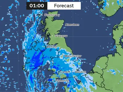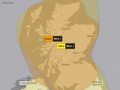
Met Office weather maps indicate that snow is forecast to fall in six areas of the UK on Wednesday, all of them located in Scotland, following the disruption caused by Storm Boelo over the weekend.
The storm brought strong winds and heavy rain to the UK, causing widespread disruption, with some areas experiencing 90mph winds. Weather maps for the coming week show that while heavy rain is predicted to continue across much of the country, patches of white and grey on the maps indicate possible snowfall in parts of Scotland.
Snowfall Expected in Scottish Highlands
According to the forecaster, snow is expected to land in Scotland on Wednesday, although it will be quite scattered. The showers are expected to begin in the early hours of the morning.
At midnight, the Central Highlands, around Loch Rannoch and Pitlochry, could see some snow. The maps also show scattered white and grey patches across the upland area west of Aberlour and inland from Aberdeen. In the Northwest Highlands, snowfall is less likely, but the maps indicate heavy rain showers.
Overnight Snow Patches Develop
By 1.30am, a more distinct white and grey patch appears inland, just west of the Pitlochry area. Another white and grey area is visible over the high ground inland from the Aberdeenshire coast, suggesting that snowfall will continue.
At 2.15am, a prominent white and grey patch develops over the higher ground between Loch Rannoch, the central Highlands and the approaches to the Cairngorms. There are also white and grey patches over the uplands west of the Aberdeen area.
Rain Continues Across UK
Blue patches remain on the map, as rainfall is still likely. The scattered white patches remain in the early hours of the morning as snowfall is predicted. At 3.45am, there is a stronger white patch between Fort William and Pitlochry, as well as another white patch over the inland high ground west of Aberdeen.
Further north of Scotland, there are scattered blue precipitation areas but fewer white patches. This is similar in England and Wales, where blue patches appear across the map throughout the day. However, this rain is much more scattered than the torrential downpours seen over the weekend.
Rain Forecast for England and Wales
In the morning, parts of the south coast and south west of England will see some rain. By midday, Wales can also expect some showers according to the maps. By 5pm, heavier rain is forecast in Greater Manchester and the surrounding areas, as scattered rain also continues in Scotland.
The areas forecast to see snow on Wednesday are: Loch Rannoch, Pitlochry, Aberlour, Aberdeen, Cairngorms, and Fort William.
The forecast for the Scottish Highlands in this period says: "Very windy on Tuesday with showers, some heavy. Winds easing overnight into Wednesday, then bright spells and scattered showers. Variable cloud and bright spells Thursday, freshening winds later."