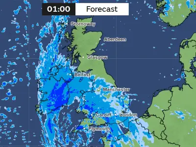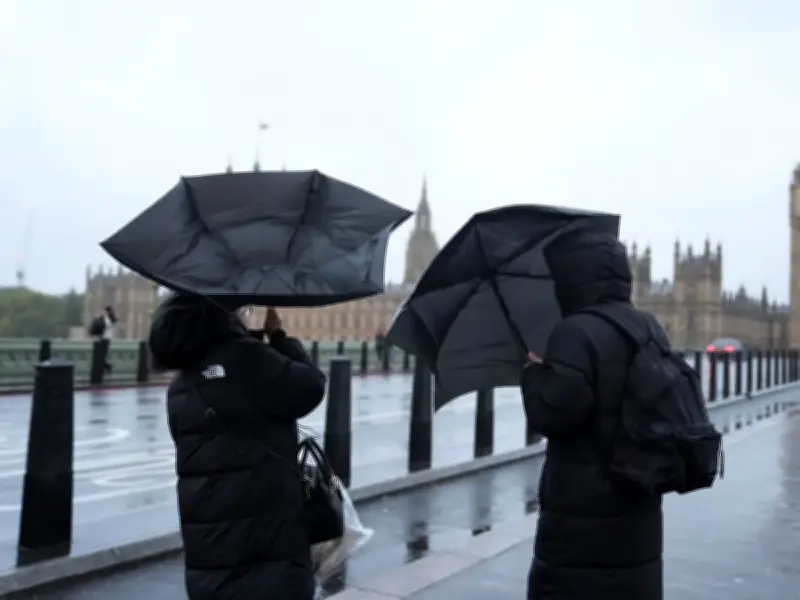
Further wet and windy weather is expected across the UK this week, the Met Office has said, as two weather warnings remain in force following a weekend of damaging winds and heavy rain.
Large parts of the country saw disruption over the weekend, including trees down in roads, public transport delays and cancellations, and large waves by coastal areas, after Storm Austen and Storm Boelo struck in close succession from Friday.
Weekend disruption and power cuts
Saturday brought heavy rain across the whole country, leading to dozens of flood warnings and alerts being issued by the environment agency. Across Greater Manchester, multiple flights were cancelled and 'do not travel' warnings issued as wind gusts of up to 65mph battered the region.
A rest centre was set up at Ashton Leisure Centre in Ashton-in-Makerfield after damage to an electricity pole on Slag Lane left around 200 homes in the area without power. The gusts brought down dozens of trees across the region, blocking roads in Cheadle, Gatley, Heaton Moor, Burnage, Wythenshawe, Moston, the A627 motorway in Oldham, and on a house in Stretford.
Metrolink services between East Didsbury and St Werburghs Road were disrupted after a tree fell on the line. Electricity North West said it was dealing with 146 power cuts across the North West on Sunday evening, with three reported in Bolton, three in Wigan, and one in Oldham, Salford and Tameside.
Wind warnings in force
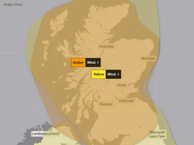
As of Monday morning, two Met Office weather warnings remain in place across parts of the UK, one of which is set to affect parts of north west England on Monday (October 26) and Tuesday (October 27).
A Met Office yellow wind alert will come into effect at 6pm on Monday and remain in place until 3am on Tuesday. The alert warns that a "spell of strong south to south-westerly winds" are expected to cause "some disruption" as wind gusts could reach 50mph. Cumbria in north west England is set to be affected by the alert, as well as parts of Northern Ireland, south west England, Scotland and Wales.
On Tuesday, another alert is set to come into effect affecting the whole of Scotland between 3am until 9pm the same day, when wind gusts could reach as high as 70mph.
Outlook for the week
The Met Office warned that further "wet and windy" weather can be expected this week. "Unsettled conditions are expected to continue into next week, particularly in the north, as another area of low pressure approaches the UK, bringing further wet and windy weather, with a wind warning already issued for northern parts of the UK on Tuesday," the Met Office said.
It continues: "Further ahead, there are signs of higher pressure becoming more influential towards the end of the week, which could bring a transition towards more settled conditions for parts of the UK."
In the Met Office's UK-wide weather forecast for Tuesday, it reads: "Early rain clearing to sunny spells and showers. Showers heaviest and most frequent in the northwest. Another windy day, with severe gales across parts of Scotland in particular. Feeling cooler."
Between Wednesday and Friday, the Met Office says that the high pressure will build again. "Showers and brisk winds easing through Wednesday as high pressure builds," the forecast reads. "Morning fog patches Thursday morning, otherwise fine and dry. Similar on Friday, but some rain in the northwest later."