
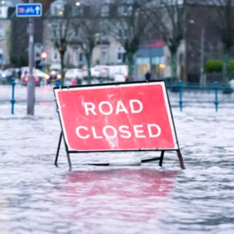
Large swathes of the United Kingdom are poised to face extensive saturation next week, with hundreds of flood warnings and alerts currently in effect across the nation. This development follows an extended period of relentless rainfall that has already impacted numerous regions.
Current Flood Alert Status Across the UK
As of Sunday afternoon, official figures from the Environment Agency reveal a total of 89 flood warnings and 223 flood alerts active throughout England. The majority of these alerts are concentrated in the south-west and the Midlands, indicating heightened risk in these areas. In Scotland, authorities have issued four flood warnings, underscoring the widespread nature of the weather threat.
Met Office Analysis of the Wet Start to the Year
Stephen Dixon, a spokesperson for the Met Office, provided insight into the meteorological patterns driving the conditions. "Rain has been reported somewhere in the UK network every single day of the year so far," Dixon stated. "While some days have seen only trivial amounts, and certain areas have experienced dry intervals, the overall trend shows a notably wet beginning to the year, particularly affecting Northern Ireland and southern England."

Dixon attributed this persistent wet weather to a succession of frontal systems and low-pressure areas arriving from the west. These systems have periodically delivered heavy rainfall and, at times, damaging winds. "There is little indication of any significant respite in the immediate forecast," he added. "Further unsettled weather is anticipated in the coming days and over the weekend, maintaining the risk of flooding."
Specific Regional Flooding Predictions
The Environment Agency has issued detailed forecasts for specific regions. Over the next five days, ongoing flooding from groundwater is considered probable in Dorset, Wiltshire, Hampshire, and West Sussex. Additionally, river flooding is expected across Somerset during this period.
For river systems, there is a possibility of localised flooding along the River Severn over the next five days. The Rivers Trent and Soar also face flood risks until Tuesday, according to agency predictions. These conditions are likely to result in property flooding and significant delays to travel services, posing challenges for residents and commuters alike.
Weather Warnings and Expected Impacts
The Met Office has escalated its alerts by issuing a yellow weather warning for rain, effective from 12 noon until 23:59 on Monday. This warning encompasses parts of London, South East England, South West England, and Wales. Heavy rain forecast for Monday afternoon and evening is expected to cause flooding and travel disruption.
Authorities have warned that the intense rainfall may lead to interruptions in power supplies and other essential services. The Independent has reported that these disruptions could affect daily life and emergency responses, highlighting the severity of the situation. Residents in affected areas are advised to stay informed through official channels and take necessary precautions to ensure safety.
The combination of saturated ground from previous rains and the forecast for additional heavy precipitation creates a perfect storm for flooding incidents. Emergency services and local councils are on high alert, coordinating efforts to mitigate impacts and assist vulnerable communities. This ongoing weather pattern underscores the importance of robust flood defence systems and public awareness in managing such natural hazards.


