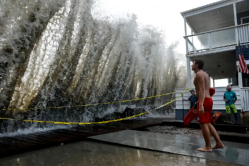
Concerns are mounting about an ocean phenomenon known as a Kelvin wave that could raise sea levels along the California coastline by up to a foot, as scientists say El Niño is supercharging the threat of storm surges and flooding in the coming months.
What is a Kelvin wave?
As an incredibly strong El Niño continues to develop in the Pacific, the phenomenon brings with it a strange shift in the ocean. The Kelvin wave phenomenon is created when trade winds that usually blow from South America towards Asia die down or reverse in El Niño years, setting off a massive, slow-moving slosh of water.
Kelvin waves are not like crashing waves at the beach. They are planetary in scale, spanning thousands of miles. And when a Kelvin wave kicks off, it brings with it an untold amount of warm water that slowly moves from the western Pacific, along the equator, towards South, Central and North America.
“You can follow them along … we see the higher sea levels along the equator, and when the wave reaches the coast of South America, it cannot continue to go eastward,” Severine Fournier, a research scientist studying ocean circulation at Nasa’s Jet Propulsion Laboratory, said. “So it goes north and south.”
Wave approaching California
One such wave hit the northern tip of South America in late August and has begun moving up towards the west coast of the US. That wave could reach California shores within days, and when it does, ocean scientists say it may raise sea levels by up to a foot for months as El Niño lingers and keeps that warm water trapped along the coast.
Nate Mantua, a research scientist at the National Oceanic and Atmospheric Administration’s Southwest Fisheries Science Center, explained that in a typical year, there is a thick layer of warm water in the western Pacific.
“When the wind stops blowing or weakens, the force that’s holding that pile of water in place goes away, so that water surges or sloshes back towards California,” he said, noting researchers expect the influence of the Kelvin wave to linger through the winter and into early next year.
Mantua said Kelvin waves were a natural phenomenon that have been happening for thousands of years and measured by agencies like Noaa since record-keeping began. But sea levels have already risen about 8in over the last century, meaning Kelvin waves will add more water on top of a figure that’s already going up.
“We can predict a lot of the impacts,” he added, “but not all.”
El Niño and storm risks
This year’s El Niño is likely to be the largest in at least 1,000 years. Climate readings have already surged past the highest temperature ever recorded for the phenomenon several months before it is expected to peak.
The climate pattern also brings with it the threat of more severe storms, storm surges, flooding and coastal erosion. For California, all of those effects will happen on top of the sea level rise the Kelvin wave brings, making the threat even worse.
“It’s a wave unlike the ones you’re used to at the beach. They don’t crash, you can’t really seem them come by,” said Mike Jacox, a research oceanographer at the Southwest Fisheries Science Center. “This winter, we’re supposed to have some really high tides around Thanksgiving and Christmas. If you also have more storms, then you have storm surge. It’s just like you’re raising the floor on all that stuff that happens.”
Preparations and warnings
California is already taking steps to prepare for a potentially catastrophic season.
This week, the state’s governor, Gavin Newsom, declared a state of emergency, mobilizing resources before any future winter storms, coastal flooding or other impacts. Road-closure and snow-removal equipment is being staged along highways; the state national guard will be prepared for any necessary search-and-rescue efforts; and agencies are finding ways to cut red tape in the event of a natural disaster.
The California Coastal Commission, which plans and regulates the use of land and water along the state’s coastline, has urged homeowners and residents to prepare now. That includes inspecting any areas vulnerable to flooding or erosion, adding drainage and addressing any causes of damage before severe weather arrives.
“A key observation from past El Niño events is that the most damaging storms are often those that coincide with the highest tides,” Kate Huckelbridge, the head of the commission, wrote in a memo earlier this month. “Storms that peak during high tides are far more likely to cause damage than if the same storm peaked during low tide.”
Mantua said past years with exceptionally strong El Niño’s – 1983, 1998, 2016 – had helped researchers better predict what can happen, and where. But with rising sea levels and the “really exceptional intensity of this event”, he said, “it may end up causing even more damage than we’ve seen in major El Niño winters”.
“Other things have been happening, right?” he said. “In the El Niño winters in the northern Pacific, we tend to have a lot of storminess, we tend to have more storms and big storm waves in the ocean than we typically do. So you add that on top of this elevated sea level … then you just expose places to more of the ocean’s energy and simple inundation.”