The El Niño event developing in the Pacific has already surpassed the magnitude of the 2015/16 event that brought severe storms to the UK, according to the Met Office. The last "super" El Niño to hit London a decade ago brought devastating storms and freezing weather, with experts fearing this winter's will bring even worse.
Storm Desmond's impact in 2015/16
Storm Desmond killed three people and destroyed over 5,000 homes during the winter of 2015/16, the last time there was an El Niño of similar magnitude affecting the UK. However, the Met Office has said that the El Niño event developing in the tropical Pacific has already "surpassed the magnitude of previous events including the one in 2015/16." The national forecaster is forecasting a stormier start than usual to autumn and winter, and colder spells at the end of winter.
London has been battered by El Niños in a number of previous winters, most significantly in 2015 and 2016. The event brought Storm Desmond to the UK in early December, with severe gales and record-breaking rainfall hitting much of the country.
How London felt the force
Though the worst affected areas by Storm Desmond were in northern England, Scotland, and Wales, the capital also felt the force of the storm's severe winds. A 90-year-old man died near Finchley Central station in north London, when a gust of wind apparently blew him into the side of a moving bus, according to a Met spokesperson at the time. The high winds were also blamed for the 60ft Trafalgar Square Christmas Tree leaning at a noticeable angle. Inspectors had to carry out checks on the tree to ensure it was not a risk to the public.
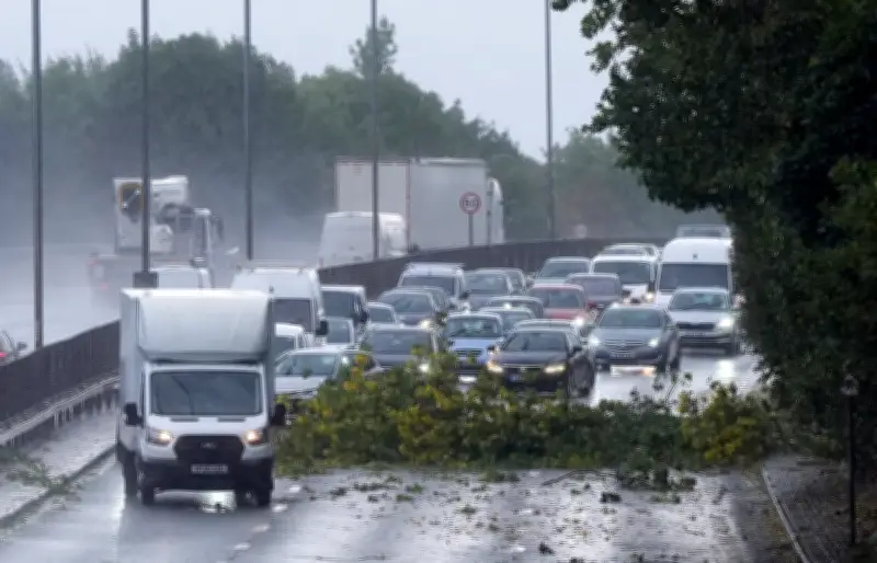
Elsewhere in the UK, the record-breaking rainfall caused severe flooding across Lancashire and Cumbria, affecting around 5,200 homes. Several major roads across the north of England and Scotland were also flooded, and there was major disruption to rail services in the north due to a landslide closing a section of the West Coast mainline between Preston and Carlisle. Over 100,000 homes in northern England lost power due to the storm.
Storm Katie and this winter's outlook
The El Niño-related storm that hit London the hardest was Storm Katie, which impacted the capital over Easter 2016. The storm brought intense gale-force gusts which peaked at over 100 mph along the southern coast of England and up to 85 mph inland. The London Fire Brigade (LFB) responded to over 100 emergency incidents. High winds bent a construction crane in Greenwich, and dozens of roofs were damaged across the capital. There were widespread transport suspensions and power cuts across South and Southeast London, with over 100,000 power outages recorded across the south of England.
The Met Office has warned Londoners that the forthcoming El Niño could hit much harder than the 2015/2016 event. Its impact will already be felt in the coming weeks - with meteorologists warning of a polar vortex that could bring icy weather and freezing temperatures to the capital.
Professor Adam Scaife, Head of Long Range Prediction at the Met Office, said: "We have been signalling for months that the developing El Niño will be an unprecedented event. The fact that it has already exceeded previous records - with several weeks to go before it peaks later this year - shows the enormity of this El Niño. Scientists are still assessing whether the impacts will be in proportion to its magnitude, but we are already seeing expected effects worldwide."
As the El Niño approaches its winter peak, there is an increased likelihood of wetter and stormier conditions across the UK during autumn and early winter, with an increased risk of cold snaps during the late winter. Grahame Madge, a Met Office climate spokesman, said: "The El Niño event is still developing in the tropical Pacific and already it has surpassed the magnitude of previous events including the one in 2015/16. Globally, an El Niño event has several impacts, including altering rainfall patterns and increasing global temperature overall. There are known teleconnections between El Niño and the UK autumn and winter period. For example, there is a tendency towards a stormier start to autumn and winter and similarly there is a trend towards colder spells at the end of winter."