
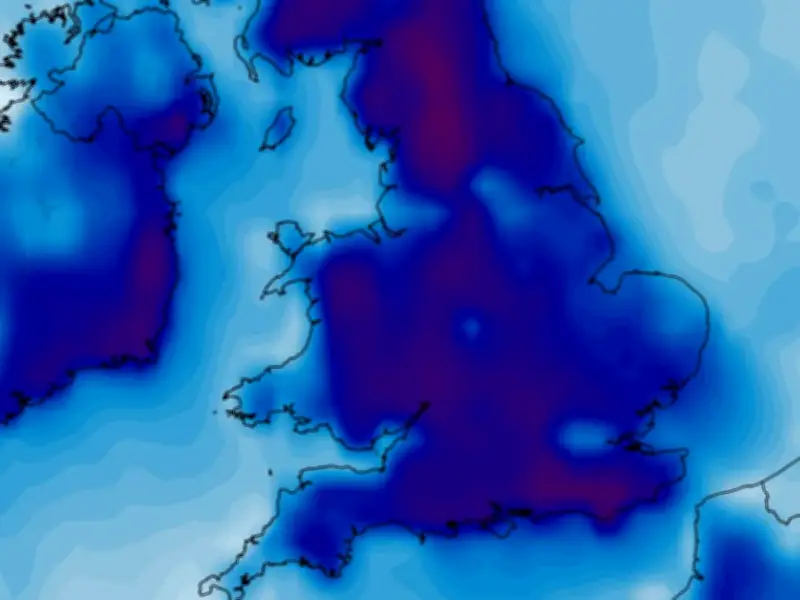
Weather forecasting models suggest a major cold snap may be just days away, with peak afternoon temperatures dropping below 10C across the UK. The GFS weather model shows the mercury plunging as low as 9C in the south-east at around 6pm on October 11, with highs of just 7C in the Midlands, 7C in Wales, 6C in Northern Ireland and 4C in central Scotland. The far north of Scotland could see -1C.
Even colder days ahead
October 12 looks set to be even colder. The data shows minimum possible temperatures of just 7C in the south-east while the warmest regions - East Anglia and the south-west - might reach just 8C. The outlook looks similar for October 13 too, again with the warmest areas possibly reaching just 8C. Temperatures over higher ground in Scotland and northern England may struggle to get past 0C throughout the day, the GFS model suggests.
Anomaly maps show deep blue and purple
Temperature anomaly maps for this period show the UK shaded in areas of deep blue and purple. This indicates that temperatures are expected to drop well below the seasonal average.
BBC and Met Office forecasts
BBC Weather suggests there is a chance of “thunderstorms” as we head into October, along with some “chillier” overnight temperatures. The BBC forecast for October 5 to 11 states: “High pressure will be anchored over eastern Europe and Scandinavia with low pressure occasionally flirting with the UK.”
“Overall, it should be a somewhat less wet week with near-average rainfall amounts but western areas may have more wet and windy periods than eastern regions. Nevertheless, there should be at least a few showery outbreaks with chances of isolated thunderstorms.”
“During drier and calmer periods there could be a higher chance of overnight and early morning fog patches, with some chillier nighttime conditions.”
The Met Office says more “unsettled” weather conditions could develop at the start of next month. Its forecast for October 2 to 11 states: “Initially, some outbreaks of rain may affect the UK, especially the north and west. These changeable conditions will probably give way to higher pressure and a more settled period of weather through the early part of the period.”
“The speed at which high pressure builds, and whether it will be focussed across the north or south, remains finely balanced. This will lead to a drier than average period overall, with lighter winds than average. Some interludes of more unsettled weather and stronger winds are likely at times, but there are mixed signals as to where these are more probable.”




