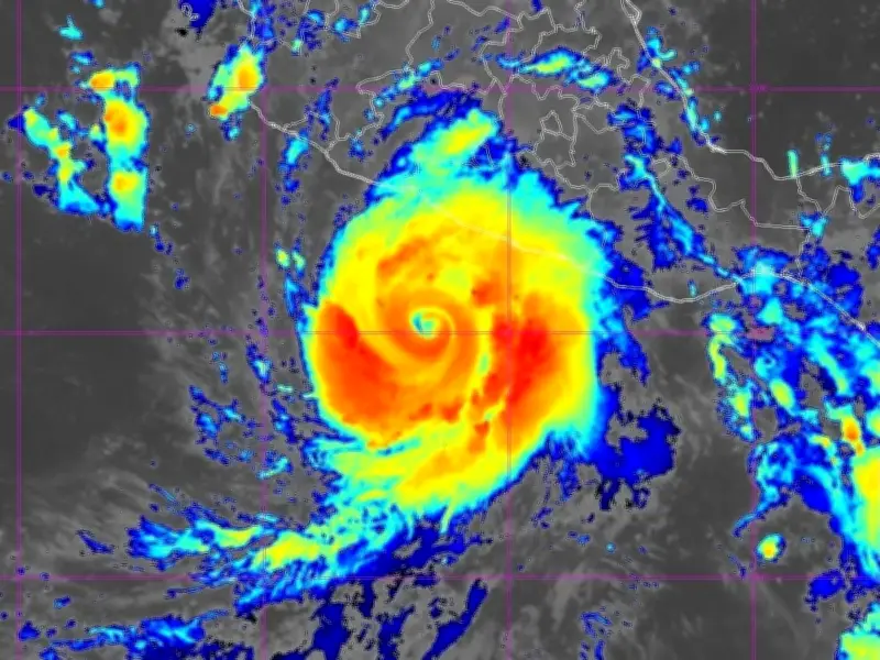
Hurricane Polo has intensified to become one of the strongest storms ever recorded, with near-record winds and extreme central pressure in the Pacific basin. The storm, which was a severe Category 5 on the Saffir-Simpson hurricane scale on Wednesday morning, is now spinning as a Category 4 off the southwestern coast of Mexico after gusts reached a monstrous 180mph.
Satellite images have captured the rare system as it becomes the second-most intense by central pressure in the Pacific basin, a strength only exceeded once in the region's history by Hurricane Patricia, which reached maximum sustained winds of 215mph in 2014.
Storm track and warnings
Polo was about 205 miles south of Zihuatanejo, a resort city on Mexico's Pacific coast, early on Wednesday, with winds of 165mph. Its core was expected to remain offshore, but the US National Hurricane Center warned of life-threatening rain, flooding and mudslides along the coast.

The US National Hurricane Centre (NHC) projected the storm to head further into the coast this week, with a Hurricane Hunter aircraft operated by the US National Oceanic and Atmospheric Administration (Noaa) deployed to follow it.
El Nino fuel and rainfall
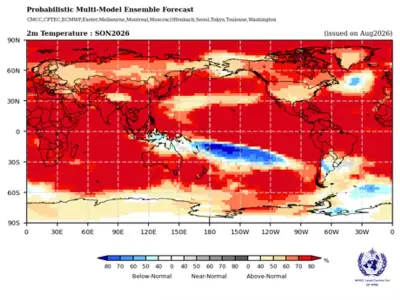
The storm is slow-moving but has ample fuel thanks to the El Niño climate phenomenon, which has seen the Pacific warm to a record 3.05C above average. Hurricanes are created by water vapour and warm air, which rises off warm seas and creates low atmospheric pressure.
Polo is expected to use that fuel to drive torrential rainfall over parts of Mexico's southwest coast, with the NHC warning it could "produce life-threatening flooding and mudslides, especially in areas of steep terrain". In total, up to six inches of rainfall - around 15cm - will fall in the storm's path, and up to eight inches in some areas as residents are warned of potentially deadly coastal conditions. Life-threatening surf and ocean swells are possible over the next few days.
Official advisories and forecast
Claudia Sheinbaum, the President of Mexico, publicly warned coastal residents, especially those in the Jalisco, Colima and Michoacan areas, to stay vigilant.
According to the latest advisory from the NHC, Polo is moving northwards, and will remain around Mexico while maintaining "very powerful" gusts as a major hurricane. The advisory states: "Polo is moving toward the north near 2 mph (4 km/h). A sharp turn to the northwest is expected to begin later today followed by a general west-northwestward motion later this week and over the weekend."
"On the forecast track, the core of Polo is expected to be near the coast of southwestern Mexico during the next day or two, although it is forecast to remain offshore."
"Maximum sustained winds are near 150 mph (240 km/h) with higher gusts. Polo is a category 4 hurricane on the Saffir-Simpson Hurricane Wind Scale. Fluctuations in intensity are expected, but Polo is expected to remain a very powerful major hurricane during the next few days."
Hurricane-force winds extend outward up to 40 miles (65 km) from the center and tropical-storm-force winds extend outward up to 105 miles (165 km).