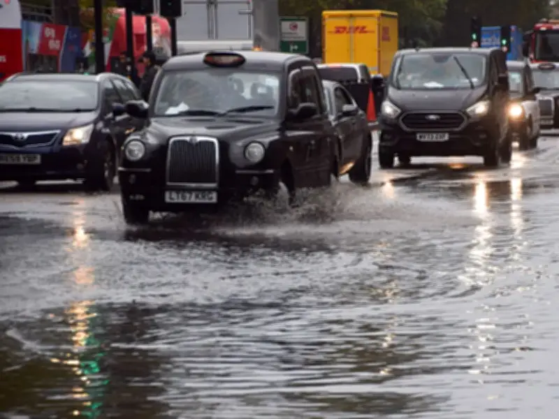
The UK is bracing for widespread thunderstorms and heavy rain this week, with 134 areas expected to be soaked, according to the Met Office.
A "Spanish plume type of system" is forming, which the Met Office has labelled "the UK's most explosive weather phenomenon". This occurs when warm air travelling north from Spain ascends and cools, resulting in the creation of thunder clouds.
Met Office warning and rainfall forecast
The Met Office states: "As cooler air spreads from the west, instability increases and the very warm air rises through the cooler air, enhancing the formation of thunderstorms."

In the morning, the rain is primarily focused across the south and southwest of the UK, with a wide band extending eastward. By 10am, the heavier rainfall is particularly concentrated around south Wales, southwest England and parts of the central/southern band.
Rain moving north throughout the day
This rainfall is anticipated to move north throughout the day, with Manchester and Liverpool all expected to experience rain by the afternoon. By the afternoon, the band of rain appears to shift generally northeast/east-northeast. Despite this, areas in Wales, northwest England and parts of the Midlands will experience the most persistent rain throughout the day.
By 4pm, much of the Midlands will be engulfed by downpours, with deep blue covering much of the map in the region including Nottingham, Birmingham and Leicester. Southern England, notably London and the southeast, will become progressively drier after early afternoon. The rain band continues its upward journey, hitting locations such as Huddersfield and Harrogate around 7pm.
Areas expecting rainfall
Areas expecting rainfall include: Lynton, Dulverton, Chard, Taunton, Bridgwater, Minehead, Weston-super-Mare, Weymouth, Basingstoke, Petersfield, Guildford, Crawley, Royal Tunbridge Wells, Hastings, Tenterden, Ashford, Maidstone, Rochester, Westerham, Epsom, Dartford, Canterbury, Dover, Bromley, Hounslow, London, Slough, High Wycombe, Reading, Newbury, Bath, Foxham, Swindon, Faringdon, Witney, Didcot, Chipping Norton, Bourton-on-the-Water, Gloucester, Ledbury, Evesham, Cardiff, Newport, Llantwit Major, Swansea, Burry Port, Maesteg, Merthyr Tydfil, Pontypridd, Carmarthen, Ystradgynlais, St David's, Fishguard, Cardigan, Llangolman, Tregaron, Worcester, Stratford-upon-Avon, Bicester, Banbury, Buckingham, Llanwddyn, Pwllheli, Oswestry, Wrexham, Nantwich, Flint, St Asaph, Caernarfon, Warrington, Chesterfield, Birmingham, Coventry, Nuneaton, Leicester, Lutterworth, Bridgnorth, Wolverhampton, Reddish, Knighton, Builth Wells, Aberystwyth, Northampton, Milton Keynes, Cambridge, Royston, Saffron Walden, Stevenage, Luton, Newmarket, Colchester, Southampton, Brockenhurst, Margate, Hay-on-Wye, Manchester, Burnley, Blackpool, Liverpool, Southport, Wigan, Huddersfield, Hull, Grantham, Melton Mowbray, Stamford, Uttoxeter, Stafford, Matlock, Macclesfield, Nottingham, Ruthin, Peterborough, Huntingdon, March, Ipswich, Felixstowe, St Albans, Ely, Thetford, Norwich, Lowestoft, Aldeburgh, Lessingham, Lincoln, Preston, Bolton, Leeds, Wakefield, Harrogate, Scunthorpe, Lancaster, Broughton In Furness and Workington.
Forecast and recent drought context
The Met Office's prediction for this period reads: "Low pressure moving in from the southwest will bring an unsettled period, with heavy downpours and thunderstorms likely each day. Turning increasingly humid, with temperatures staying a little above average."
The development comes after this summer left Britain so dry during the drought you could see the effect from space. Satellite images of the UK have revealed the state of the dry conditions after weeks of severe drought. Footage taken by EU satellite cameras shows huge swathes of yellow and brown across the country, painting a desperate picture of a landscape in desperate need of rain. While much of the country has been struggling, things have been especially bad in the South. In the photos, London's iconic Hyde Park is seen almost entirely scorched. In stark contrast to last year's photo – which shows large areas covered in green grass – this year's image shows that patches of grass are few and far between.